Leaderboard


Popular Content
Showing content with the highest reputation on 06/11/2019 in all areas
-
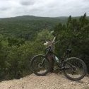
Walnut is both "Complete Hero Dirt LOL" and also "Sofa King Muddy and Unrideable". It should be renamed to Schrodinger's park4 points
-
PP is open Get ya some Sent from my Pixel 2 using Tapatalk3 points
-
2 points
-
It's going to be next to Lake Creek Park, 3300 Brushy Creek Road. We have some of the Pavillions rented out there and there is ample parking + toilets, so It's going to be a better location for everyone. I'll be building a temporary start/finish line on Friday2 points
-
Of course 2nd week in a row I plan on riding R&I, load my bike, and the rain comes.1 point
-
You guys are going down some of the same roads I did. I finally gave up and posted for help. But then I found a different way to get something useful even if I didn't understand what those numbers meant (they were listed on a drawing as "Coordinate Points". I suspect you have to have the secret decoder ring to figure out where those were. I found a KMZ file. I converted that to GPX file. My Garmin still could not figure out what was intended in the ~ 5 meg file. I tried Strava and TopoFusion without much luck. But when I imported the GPX file into Ride With GPS - it read the file and gave me something I could work with. The GPX file was about 30 short segments. My Garmin only took the first one. RWGPS listed and previewed each and everyone of them. I was able to look though the files and pick out the ones I needed to combine to make what I needed. So even though I still don't know what those numbers meant - I have a track I can use.1 point
-
June Bug, are you sure you didn't mean Leanderings; this is central Texas, after all.1 point
-
You won the internet today in my book.1 point
-
That cloud is the hero dirt maker 😉1 point
-
I'm just south of WC (directly under that green blob ^^) and it has been trying to rain for about an hour. It hasn't so much as gotten the road wet. If that remains the case, then it'll be fine. Assuming the roads are dry at 4:00, I'll be biking to R&I with an approximate 4:30 ETA.1 point
-
It's a public park. Not sure they can stop you from setting up a simple thing such as that. Not sure though Sent from my SM-G950U using Tapatalk1 point
-
I've seen people do it in the parking lot. Never seen it in the field, I've no idea if it allowed.1 point
-
Yes, the eastern route is what we took for Tour de Cure. I'll try to dig it up from my archives.1 point
-
With a high of 82, it's going to be nice and cool out there compared to what we've seen the last week or so.1 point
-
So who all is signed up to race this event? Sounds like they're getting some more cash added to the pot. From FB: t just got real! TOYOTA of Cedar Park threw their hat in the ring as a sponsor. We will be splitting up a 500$ cash purse between six overall categories for men and women for fastest SINGLE lap time on the day. That’s an $83 cash payout for making one of your laps a complete do or die and be fastest in your cat and taking potential top step winnings in each overall category to damn near $200. You can be a first time racer in cat-3 division and win $183 in cash. BUT WAIT THERE IS MORE! Toyota will have a trio of absolutely bad-ass vehicles on display. Thank you Cash White with Toyota of Cedar Park for your generous sponsorship. If you are buying a Toyota soon, buy it from the guy that supports MTB racing and trails!1 point
-
Do you still want more brought in from Peddlers Pass? Sent from my SM-G950U using Tapatalk1 point
-
Thanks June Bug! I was looking whether that was the case, or whether it was remnants from the cretaceous period. While researching, I ran into this which some may find interesting/useful. I learned some things: https://www.cengage.com/custom/regional_geology.bak/data/Texas.pdf1 point
-
I was going to point you to the Bike Austin Kyle ride, but it looks like they no longer do it. I wonder if that says something about the route? I know that even a few years ago. OSR didn't seem the safest road to take. I did the Tour de Cure a few years back from San Antonio to Austin, but it was a lot more circuitous route. I bet some of the south folks will post with more recent info. I feel more comfortable out of the city. IMO the suburban FM/RM are the worst.1 point
-
Double Down is double delicious1 point
-
Peddlers Pass: G2G 1/4 Notch is G2G. Watch for remaining low wet spots. Walking to Picnic now. *Update* Picnic: Almost okay. Number of soft spots that result in caking. I’d recommend to give it until tomorrow. Other trails: Unable to check. Snow White will be okay, while trails like Gum Drop may be too soft. USE CAUTION1 point


.thumb.jpg.07ee12b2da3df67be485333447c664f3.jpg)
