
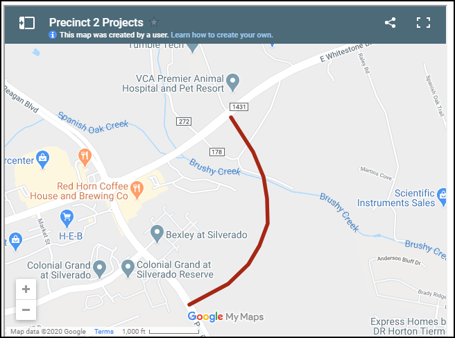
I saw this article on Community Impact, and it was the first time I saw the Toro Grande extension mentioned, so I googled more. This article from May 10 has an embedded map on which you can zoom in. I wonder how accurate the red line projection of the road is and where it will go in relation to the church. Add to this area the extension of the Brushy Creek Trail, and this area will see some significant changes, though the impact on SJ is mostly unknown.