
WhoAmI
-
Posts
300 -
Joined
-
Last visited
-
Days Won
16
1 Follower
WhoAmI's Achievements
")


-
I'm a decade behind you and have changed my mind about e-bikes over the past few years. I'm not opposed to owning an e-mountain bike when my body can no longer perform like I want it to, be it continue to climb well or hold up on longer rides. On my nex trip to Bentonville with a group of friends, I want to rent one probably on the last day we're riding.
-
Interesting....
-
The last time I rode HCSNA...over 15-20 years ago, it was chunky in places with steep climbs and little flow.
-
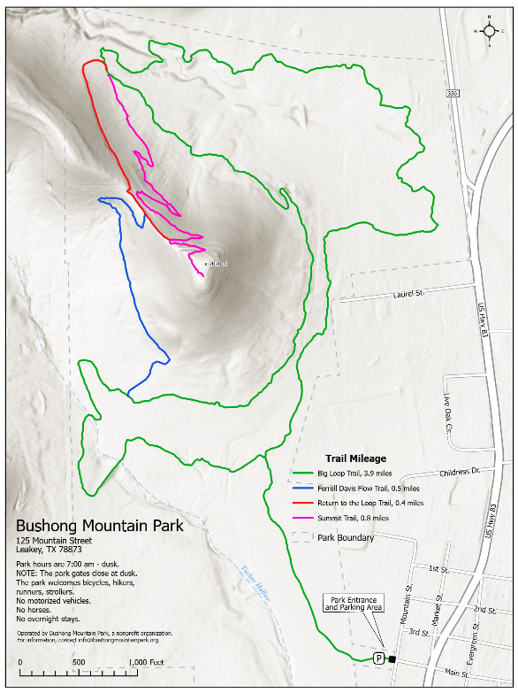
Not enough miles for me to want to go. Plus, the primary photo of the trail looks like it was surfaced with limestone gravel.

-
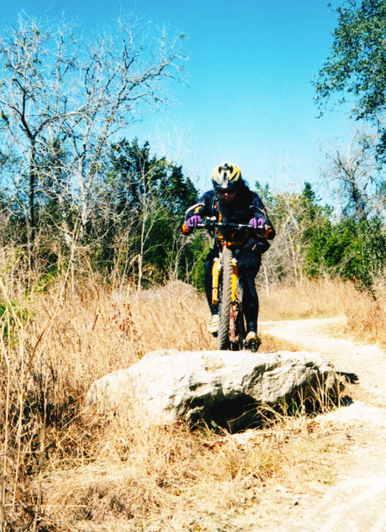
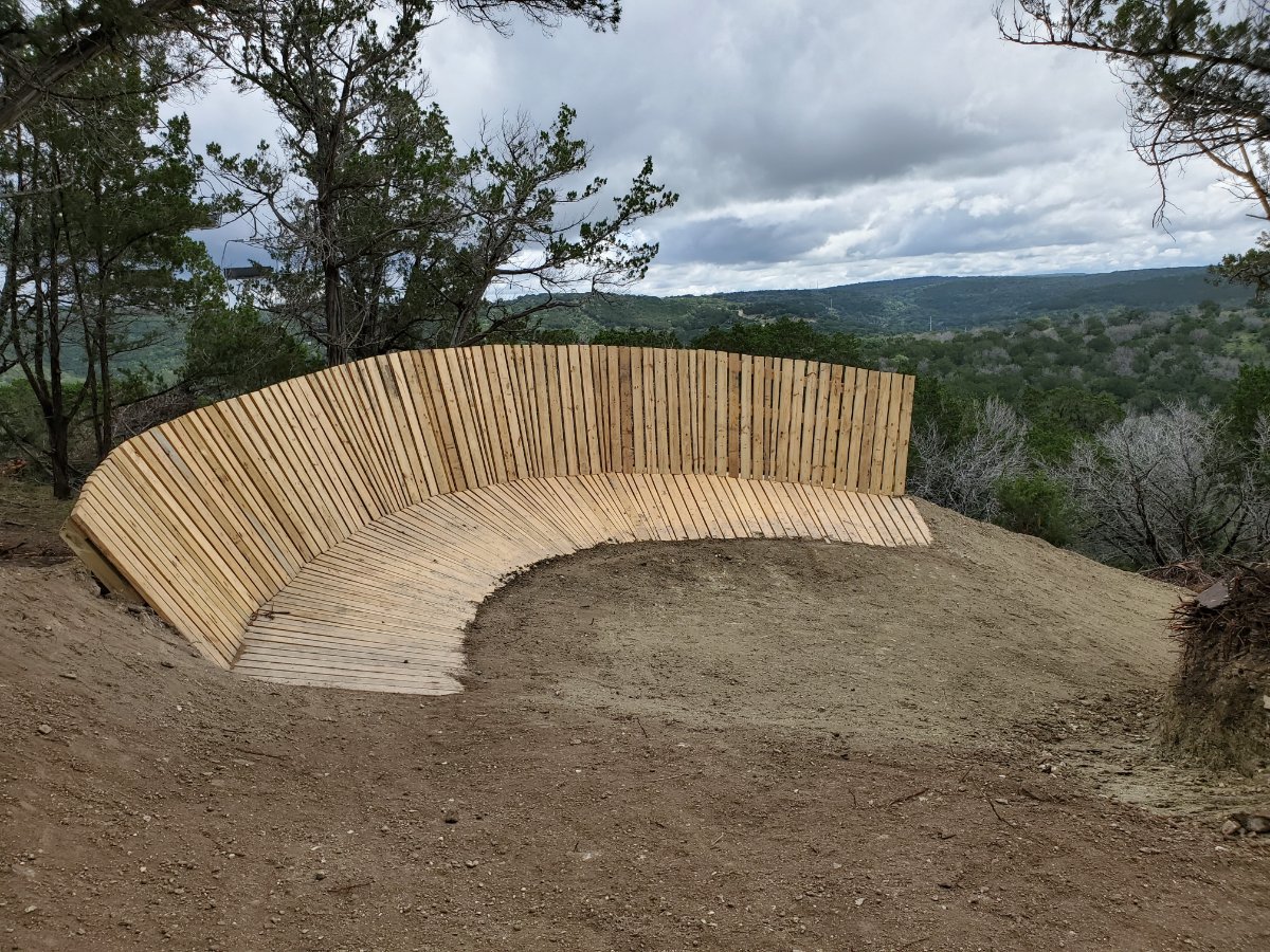
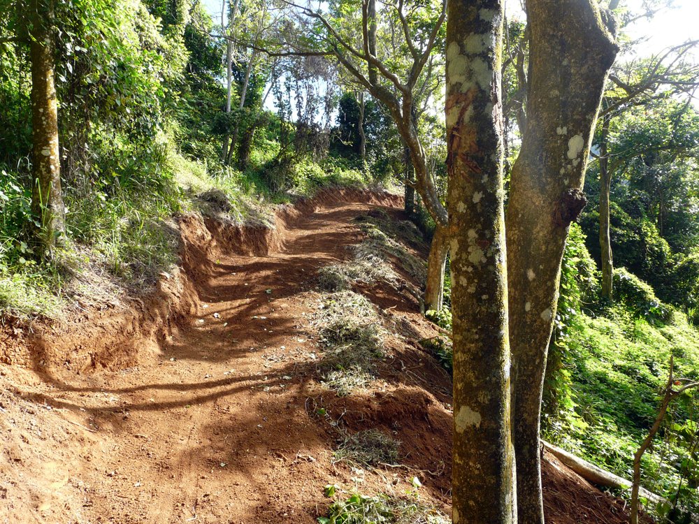
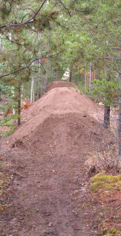
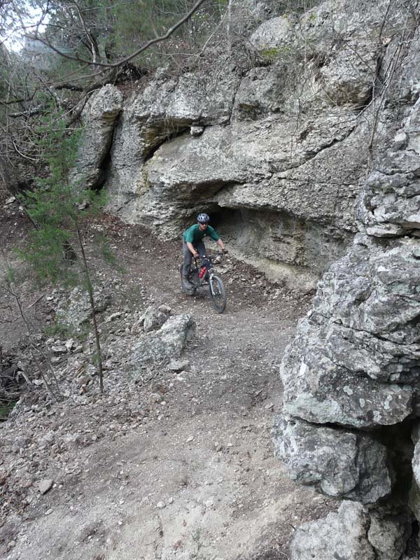
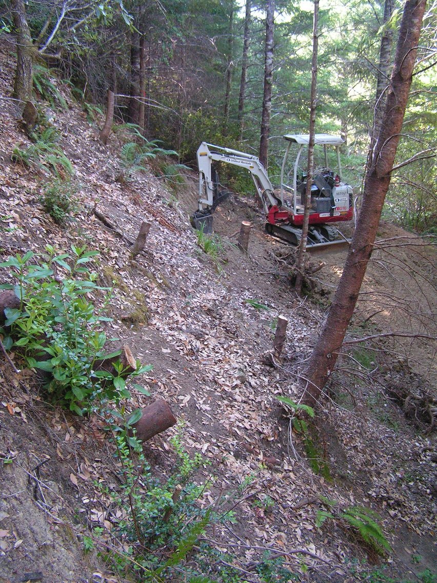
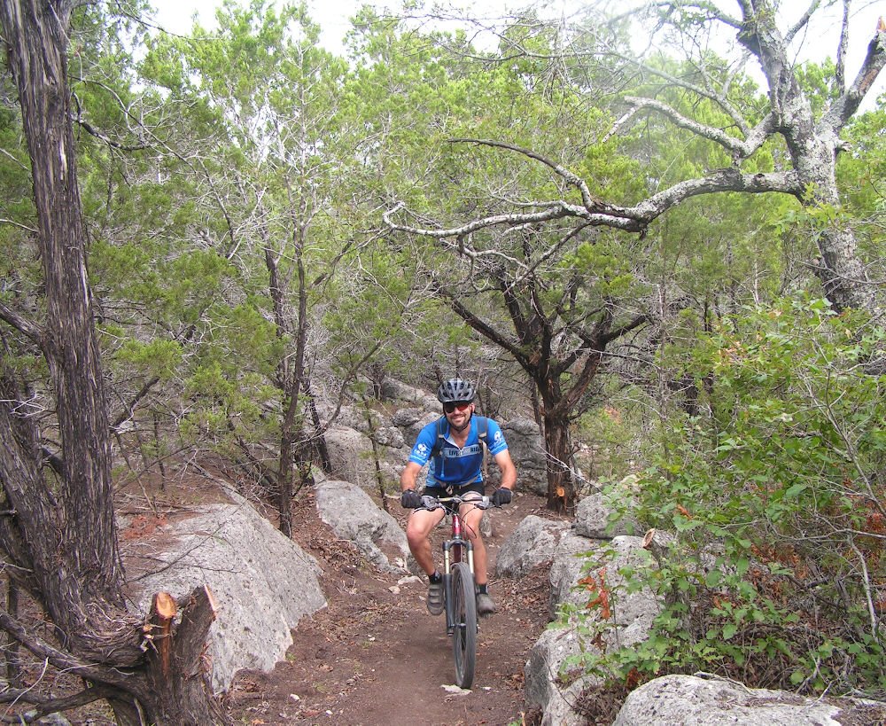
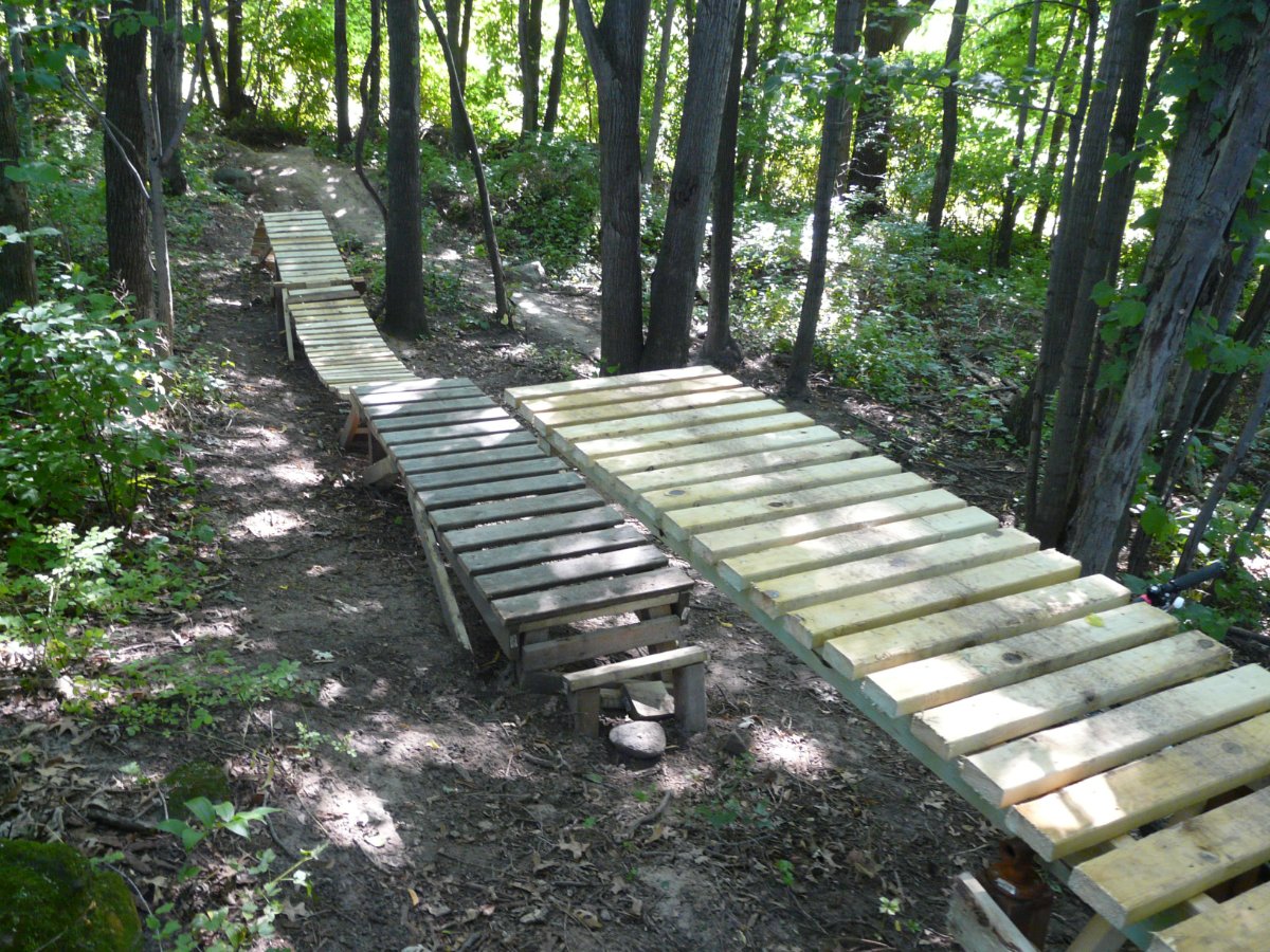
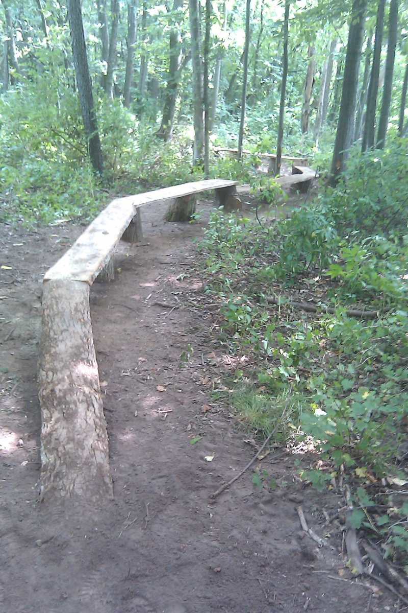
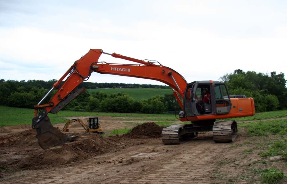
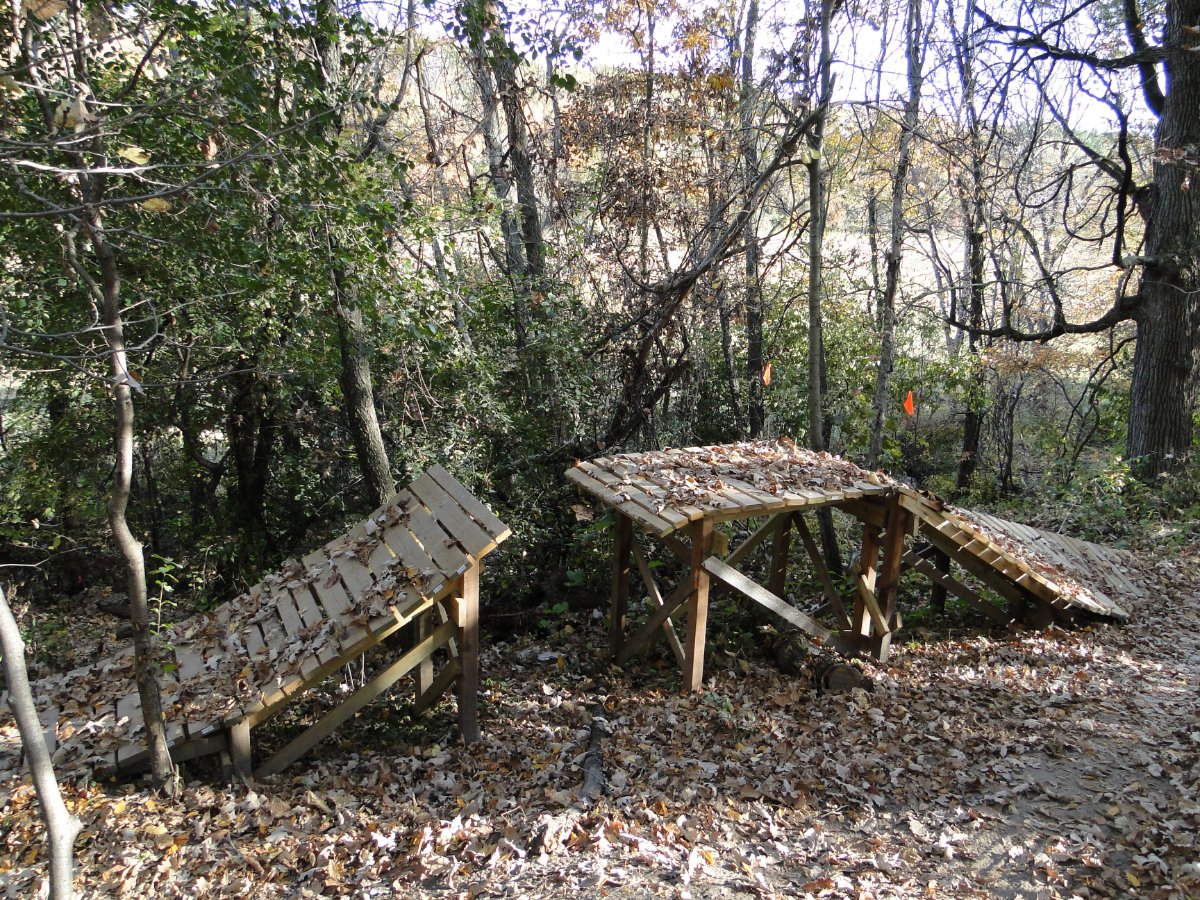
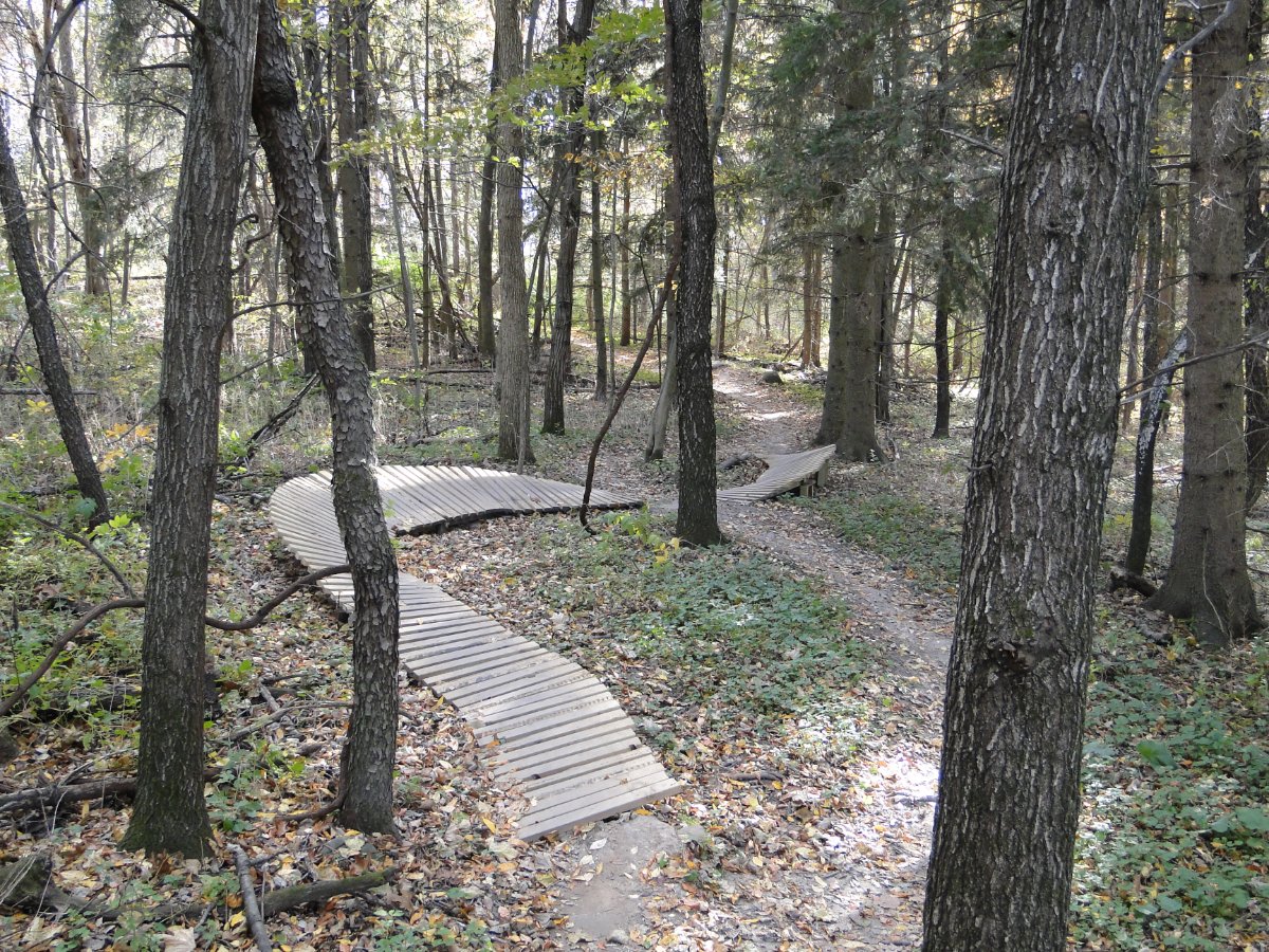
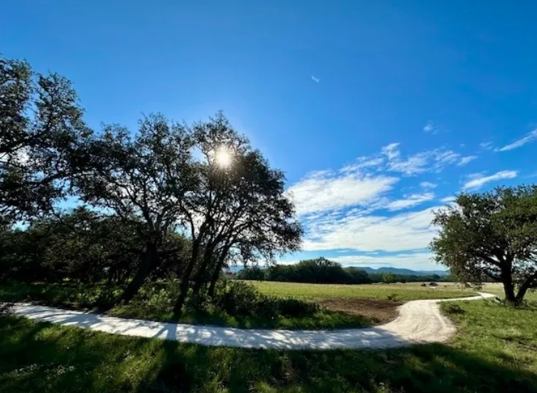
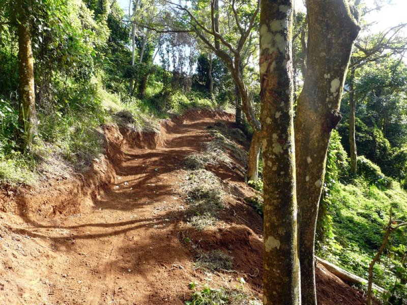
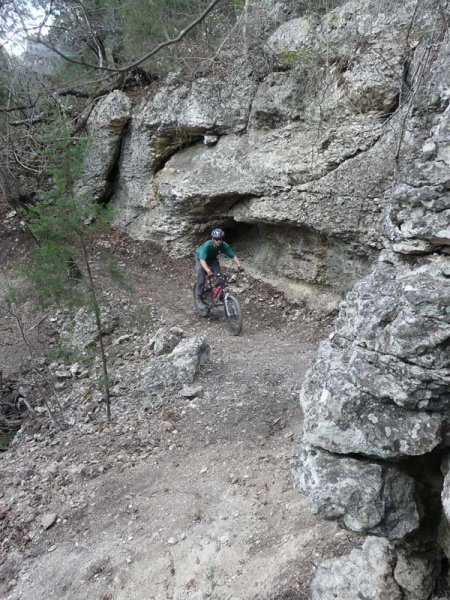
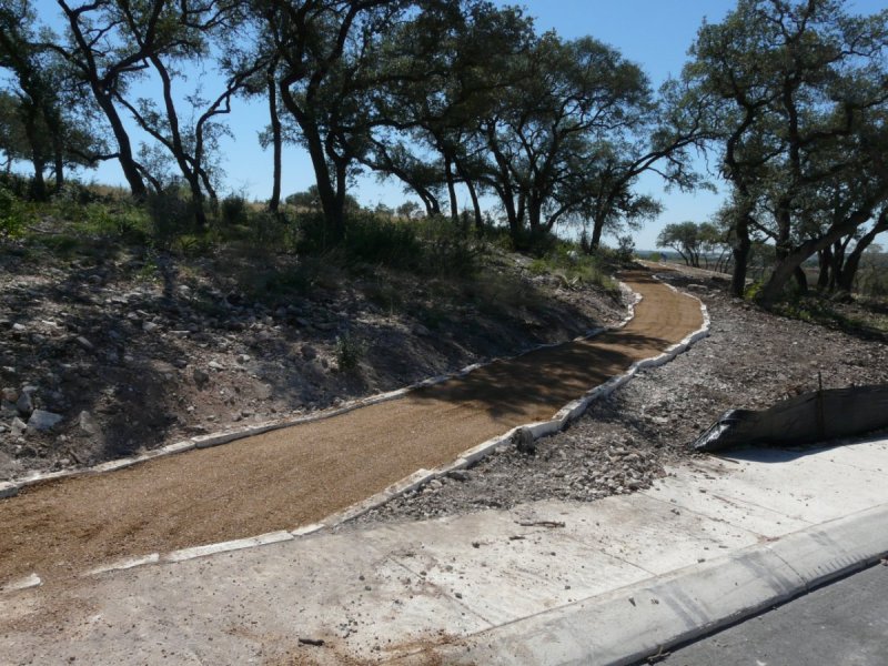
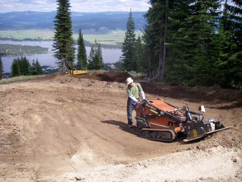
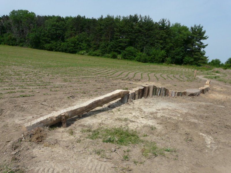
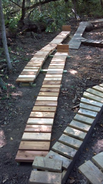
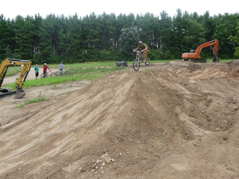
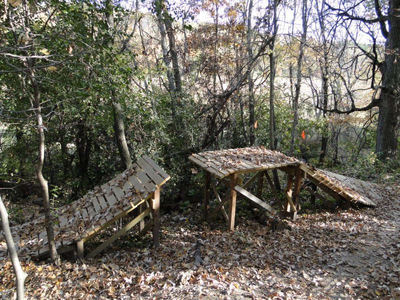
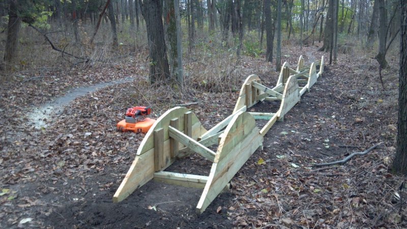
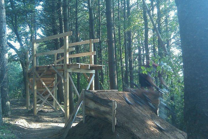
I posted some of these pictures on an Austin Mountain Biking Facebook page and wanted to share some of them and others here. The photos are from various trails in various states from when I started the first professional trail building company in Texas, Talon Trails LLC, in 2004, worked for Trek Bicycles designing and building their test trails, and volunteered with local clubs. I designed and/or built trail in 14 states, Canada, and Puerto Rico, and enjoyed almost every bit of it. While I miss designing and building trails and features, my life & priorities are a lot different now.


-
Damn, Maureen! I'm sorry this happened! I don't have a recumbent but can offer sympathy. 😞
-
Also, the purpose of the post was to let people know that you can add data in Open Street Maps that will then be added to RWGPS. I find this super useful b/c I connect through green spaces and other places where there is no connecting line in RWGPS, which means I have to draw the trail or line every time. Adding it to OSM means it'll always be on RWGPS.
-
I am not paying to use the app. I create the route in a browser on my PC then save and upload it. When I start and sync my Wahoo Roam, the route is there.
-
I use Ride With GPS (RWGPS) frequently to plot my rides and send them to my Wahoo Roam to load then follow. Sometimes, a trail or connection is missing, and I have to switch to drawing a line, which is cumbersome when drawing a trail. I found that you can add trails on Open Street Map (OSM,) as RWGPS uses data from this site (and Google Maps) and pulls the data about every other week from those sources. If you use RWGPS and find yourself having to draw lines instead of following trails, create an account on OSM and get to work! It's not the most intuitive, and there is a tutorial. Once you figure it out, it's not difficult.
-

Lakeway Route Suggestions for Sunday, 09/15/2024
WhoAmI replied to WhoAmI's topic in Mountain Biking Discussion
I can navigate the trails are they were 10 years ago but don't know the new(er0 stuff. A buddy of mine sent me a route from one of the ASS rides, so I have it loaded on my Wahoo. Thanks! -
Lakeway Route Suggestions for Sunday, 09/15/2024
WhoAmI posted a topic in Mountain Biking Discussion
I know this doesn't leave much time for me to get a route, but do any of you have a favorite route you like to ride at the Lakeway Trails? We prefer an intermediate to advanced ride from 10-16 miles taking into account the elevation out there. If you have a link to a .gpx or other file I can upload to my Wahoo Roam, then it's even better. Thanks! -
Check page 25 of this document maybe.
-
Man, I haven't seen Bart in ages!
-
FTFY. 😑
-
Does anybody recognize it from before the bridge construction started for the concrete trail over Walnut Creek to east of Lamar? This photos is of my brother back around 1995 or so. Spoiler alert: The approximate location is linked below the photo. Approximate rock location