

gdog-1992
-
Posts
56 -
Joined
-
Last visited
-
Days Won
1
Content Type
Profiles
Forums
Gallery
Calendar
Posts posted by gdog-1992
-
-
Fortunately at this point, there seem to be very few hikers on that side of the "lake". I have gone up some trails that are generally downhill out of ignorance. What I'm more interested in is someone getting at least a crude sketch of the 7 different runs. Timing hasn't allowed me to go when many others go out there (like crank & drank) and it's really hard to tell from Strava exactly which run is which. And before anyone says it, yes I do just go ride them and try to figure them out for myself so the sketch is more of a semi-assurance I'm sticking to the general plan.
-
I was actually surprised the Tektro M280 mechanical disc on my 6-year old son's Trek Roscoe 20" had adjustable levers. Thankfully they were because we wouldn't have gotten the bike if the tech hadn't adjusted them for him as it was almost impossible for him to reach them as they were originally setup. So I feel your pain on that. It's a great bike by the way for anyone looking. Kid-friendly geometry with rigid fork and plus size tires that roll rocks nicely. He loves the bike, now I just need to get him and his older brother out on the trail more (older brother has Specialized Riprock 24" - like that too but could do without the heavy (useless) suspension fork).
-
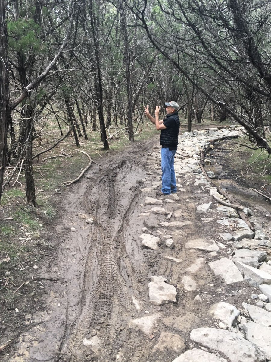
11 hours ago, cxagent said:
Hmmm. My experience does not match your suggestions. We armor the whole trail - like 10 feet wide. Solid rock for 10 feet. People ride around the rock armoring. The only thing that works is to pile brush on either side of the armoring so that if they want to ride in the mud, they have to stop and move the brush. They still stop and move the brush but it slows down some of the mud riders.
Attached is an example picture I found easily. (Too many pictures make it hard to find the one I want.)

Clearly that armoring has created a rock garden that is too technical to ride. I mean - where's the line? 😉
-
1 hour ago, The Tip said:
People are amazing. This is a picture from under the Lynnbrook bridge at the end of "Over the River and Through the Woods" in Bauerle Ranch.

A perfectly good armored crossing ignored to get one's bike all muddied up. Very strange. This is not a "look how ruined the trail is" picture. It's more of an illustration of how poor people's powers of observation are.
I wonder if some of that is people crossing when the water's up where the armoring can't be seen. Just a thought as I also wouldn't be surprised that there's people who are scared of riding on the rocks as well.
-
47 minutes ago, The Tip said:
I have saved as favorites three Strava rides where the rider attempted to do all of the SATN. Here is one: https://www.strava.com/activities/1677023345
"behind ATX Bikes" is Circle C Metro park. The gravel trail around the soccer fields is where you most likely road before. The playground is on it.
There are three trails that go under Mopac into the Veloway single track trails. More flowy fun stuff. Not much tech, not much elevation.
There are also several dining options in the shopping center there.
I've taken my boys (6 and 8 now) on a few rides in Circle C park trails between Escarpment and Mopac. The north bank trails are really good for that age, just a few rock gardens without much up/down climbing. Post-SATN ride good options are Waterloo Icehouse on Escarpment just north of Slaughter (has beer, obviously and an outdoor playground) with an ice cream shop right next door to boot. You'll have to cross Slaughter but easily doable at the light at Escarpment. My boys also like Zpizza after a ride (few doors down from ATX bikes). As The Tip said, you can also hit the gravel trails west of Escarpment to get to the playground/ball fields. The single track on that side is probably a bit above level for now as there's more up/down and tech on that side of Escarpment.
South Austin Trail Network, The SATN
in Mountain Biking Discussion
Posted · Edited by gdog-1992
Thanks Greg! That is really helpful. I've been over there quite a few times already so this all makes sense. There is also access from Avana (where I live). It's hard to explain but there's basically a trail entrance on a culvert near the intersection of Bernia & Mundomar (entrance is on west side of Mundomar). You then take that to some jeep roads and ride the jeep roads to get closer to 1826, where the jeep road that turns into Ski Lift begins. If I could figure out how to post a Strava image, I'll post a track.