

Scorpionwoman
-
Posts
27 -
Joined
-
Last visited
Content Type
Profiles
Forums
Gallery
Calendar
Posts posted by Scorpionwoman
-
-
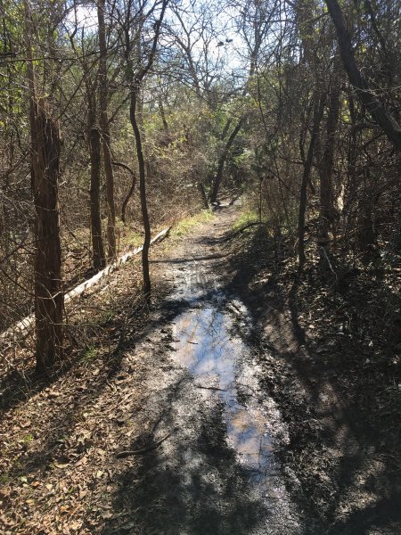
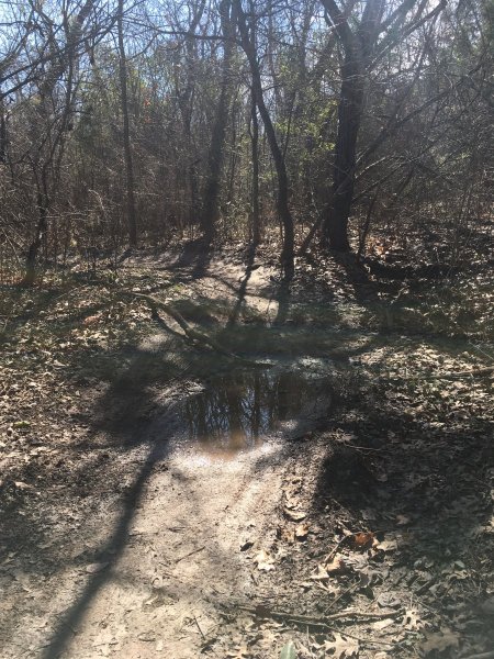
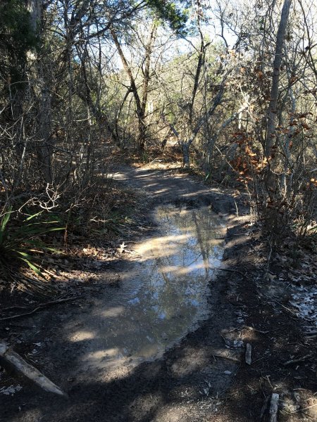
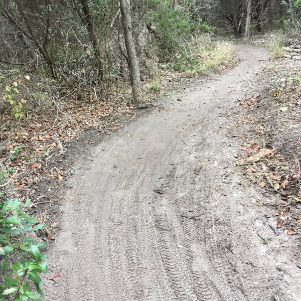
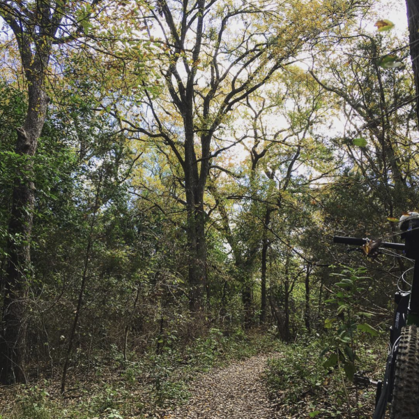
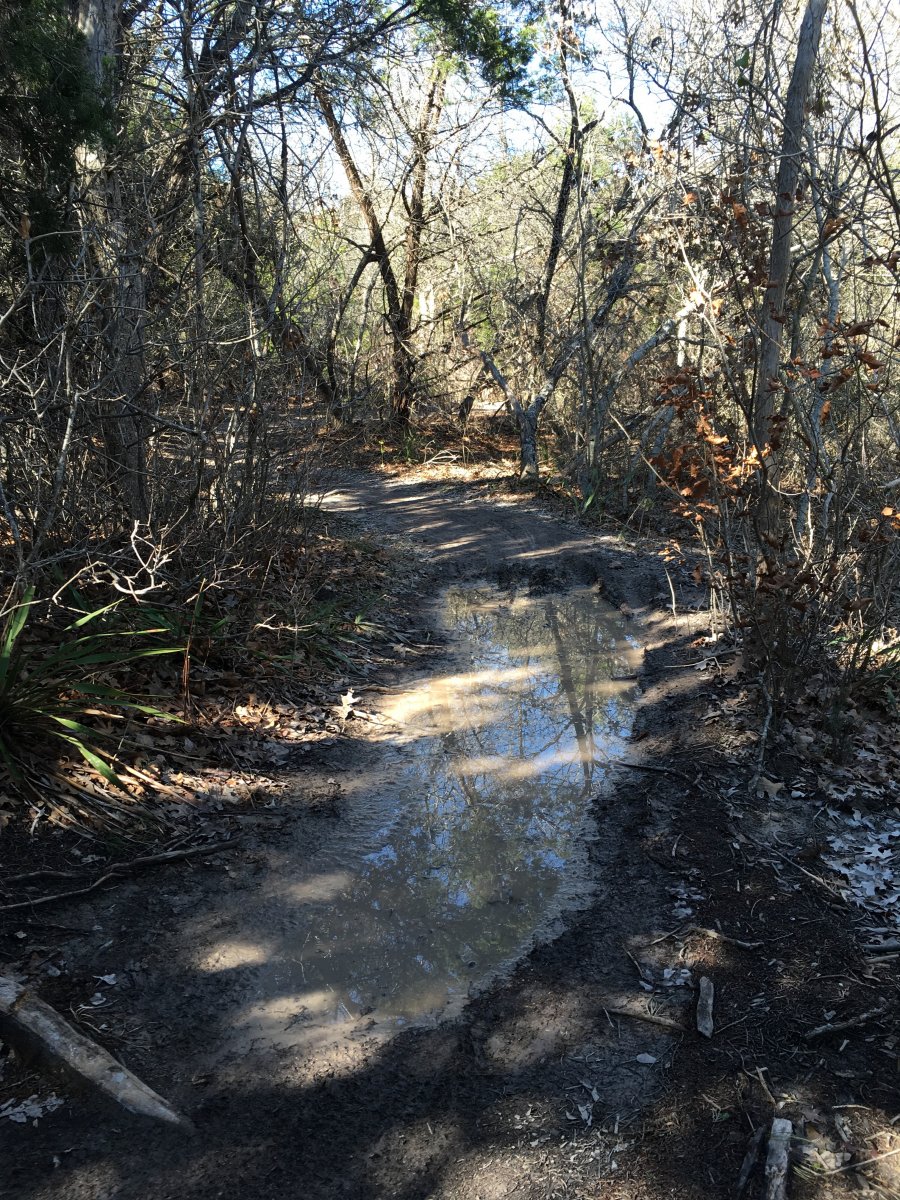
Got out for a run at midday today. Walnut is not ready for riding, yet. I was a little surprised at how wet it is. Here's a sampling of spots that stood out to me.
1. Outer log loop. Don't know if you can see it, but there's another puddle on down the trail, at the curve to the right.
2 and 3. This is on the climb in the middle of the Tangle of Trails section. The first one is not too far into the loop. The second is about half-way up the climb. I've never seen puddles in either of these spots before.
4. Tar Branch (I think that's what it's called. The little loop that's not far from the power lines that drops down and climbs back out). This is not far from the entrance to the loop off Shady Springs.
Hope that's helpful info.
clair

-
Anyone get out to Walnut this afternoon? I'm hoping there wasn't much rain last night...
-
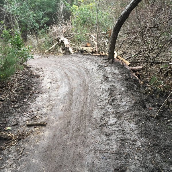
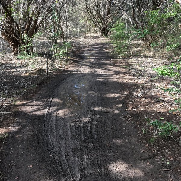
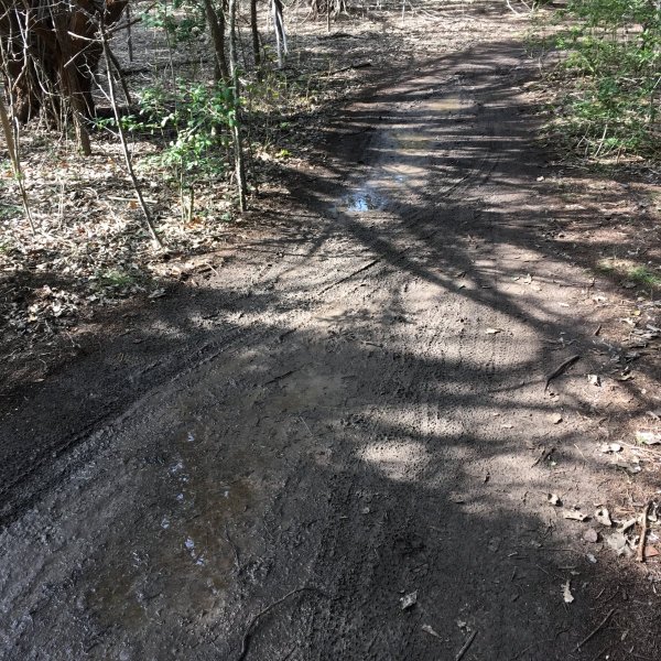
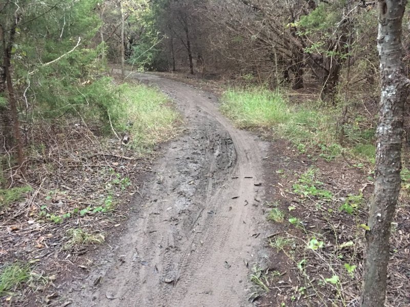
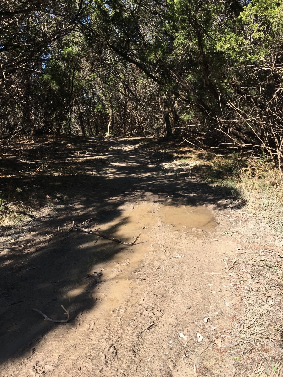
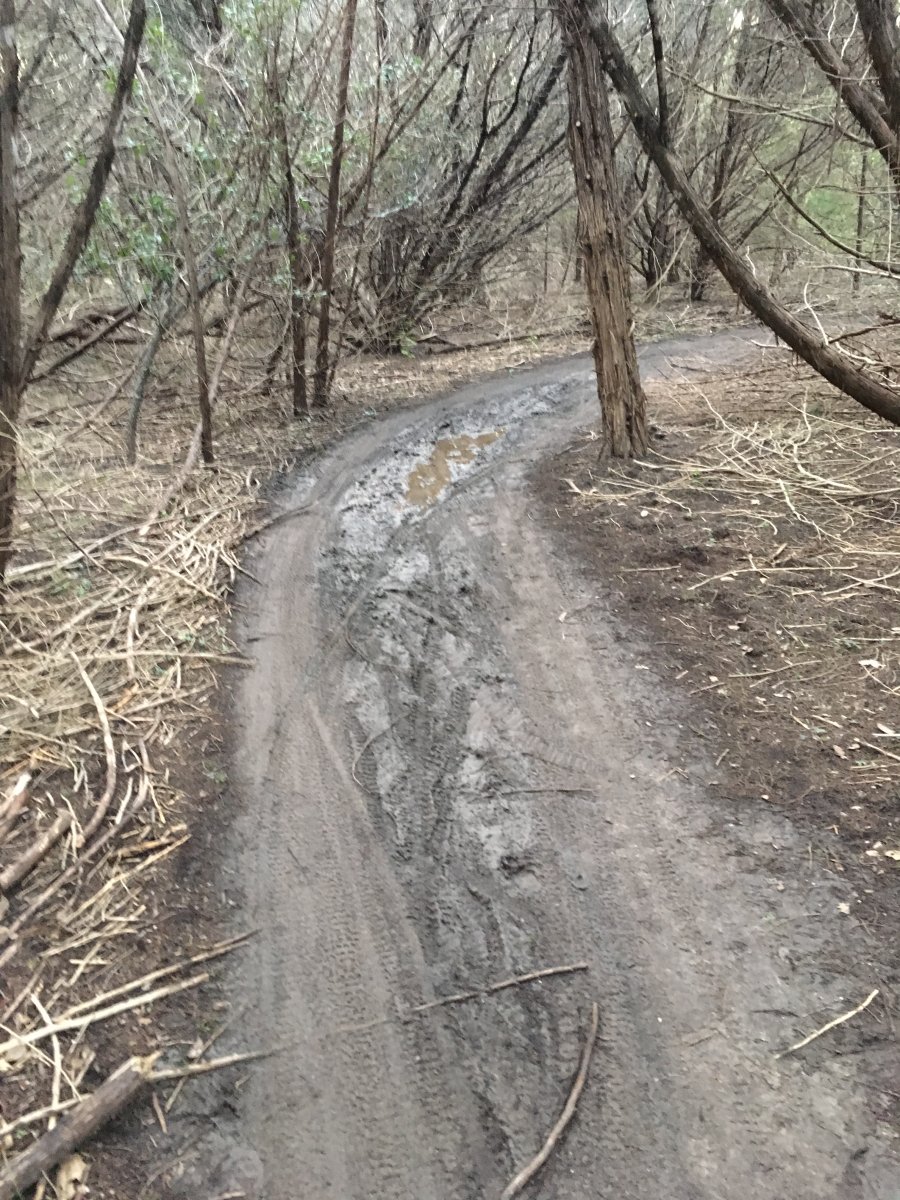
Since the last report of Walnut trail conditions was on Monday, I thought I'd do my run out there today and see how it fared after a very damp Wednesday. Bottom line: it's wetter now than it was the first part of the week.
As others have commented, the log loops take water *so* much better now that our wonderful trail volunteers have done all that work on them. But by riding them when they are wet, we are breaking down the improvements. Here is an example in pics, at the S turn about midway through. Those tracks represent quite a few riders on the trail after Wednesday. It's muddy enough that there was some sideways slipping.
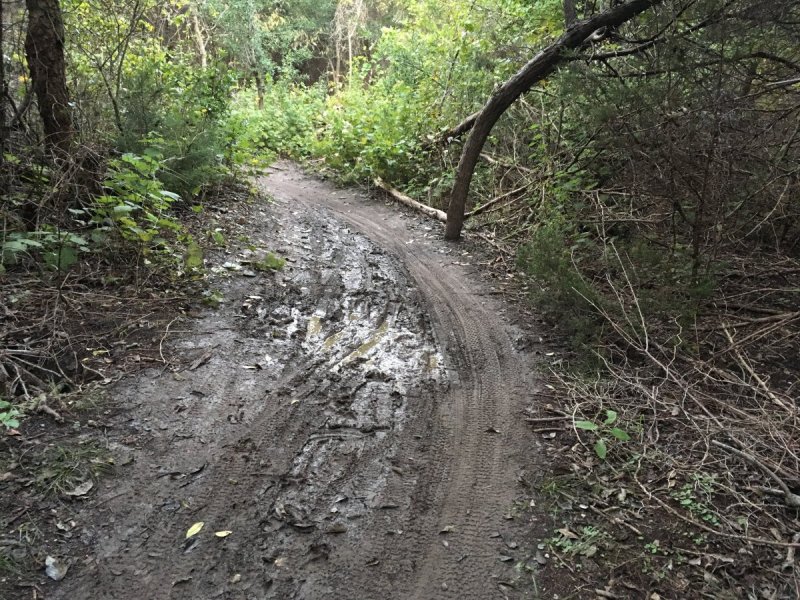
In addition, the places on .6 that were built up on one side with the water-diverting channel on the other are getting broken down, because the ground is muddy (even on the high side) and riders are sliding off, dragging the dirt with them. Also on .6, spots that did not hold water a few months ago are developing into mud pits.
Please stop riding Walnut when it is wet.
-
It seems the "Walnut Creek" thread has plenty of people reporting on conditions, even providing specific info on *which* loops should be avoided. There were several loops that were too wet to ride last Thursday, and the info was there for the taking.
-
 1
1
-
-
7 minutes ago, CopeIt said:
I rode the path today and ended up checking out powerline flow, chardog, and log loops. All good to go. Was skeptical about log loop but whatever improvements were recently done took care of the areas that used to hold onto water forever. Great job

I ran and concur with that. But that's pretty much all that is ridable.
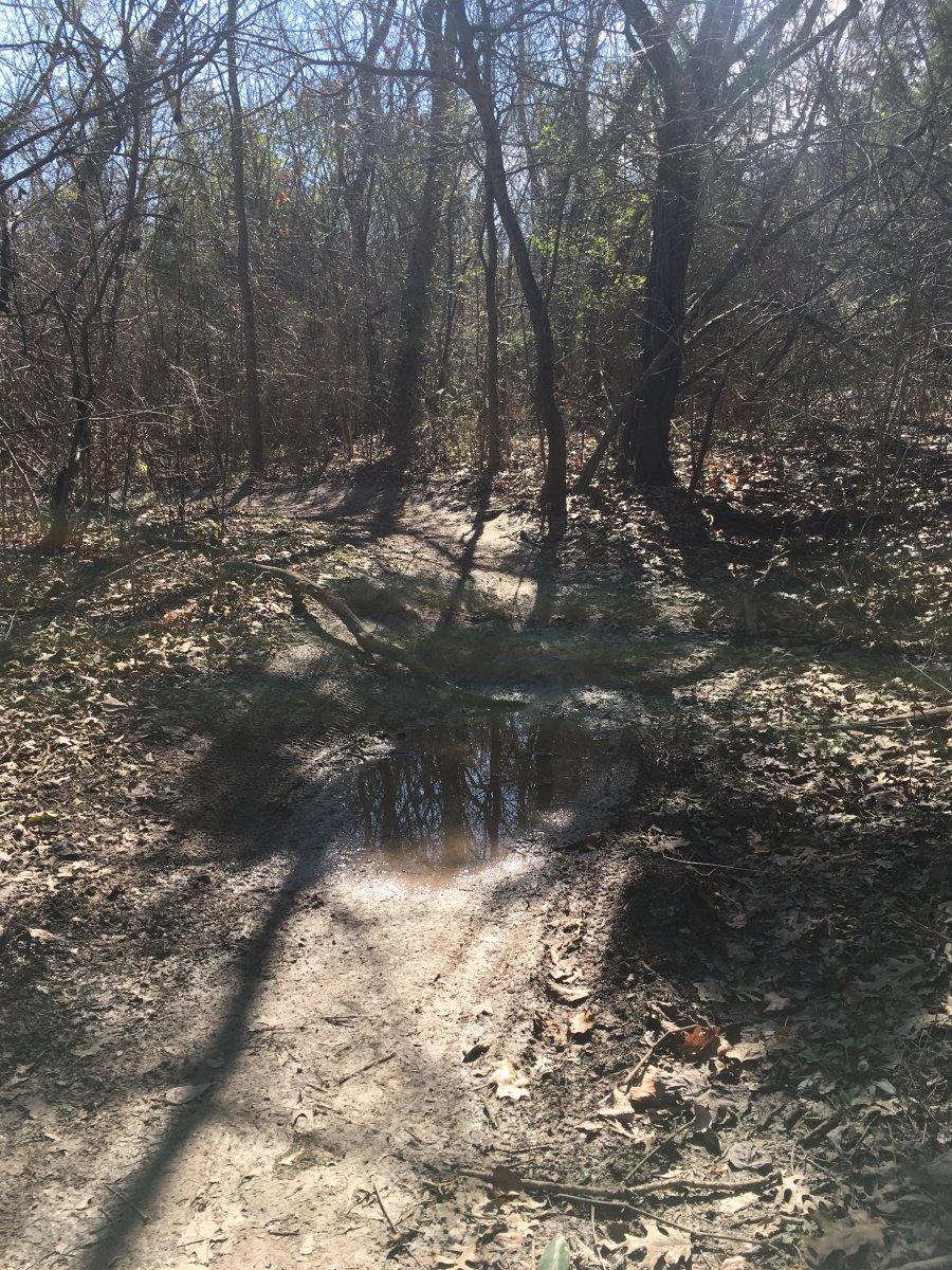
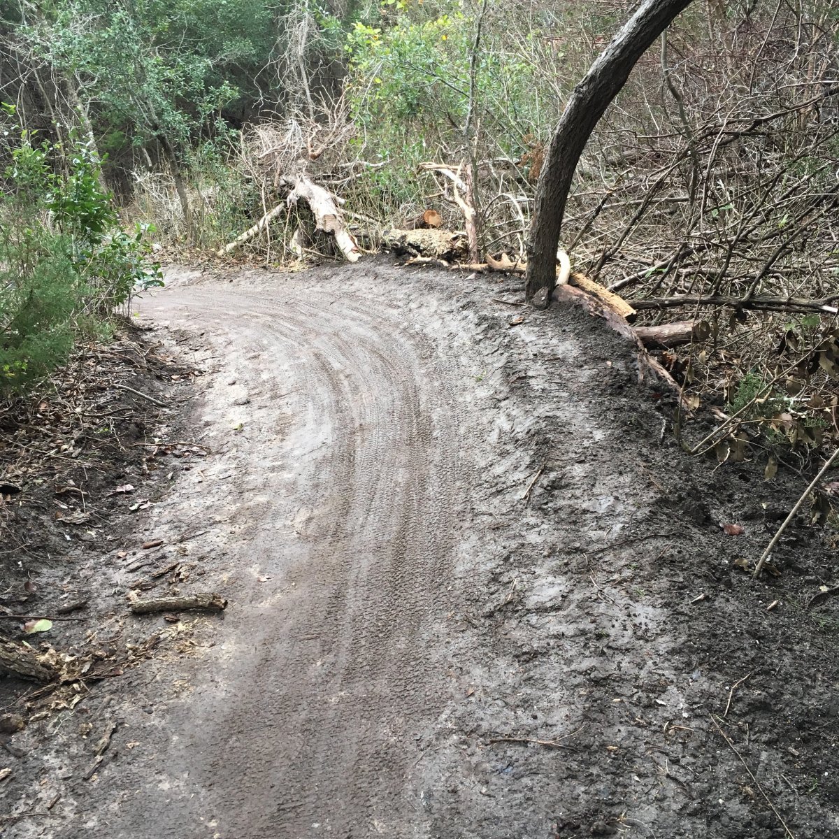
I went on .6, and it was not good. In addition to the spots that usually get muddy, there is a new low spot developing not far into the loop, before the first sweeping turn to the left. There was still standing water there today. (Pics below.)
I am confident Windy and BMX are not good, since they were muddy even before Friday night's rain. I also am confident that Mark's Art continues to be muddy in all the dips, meaning that the rock armoring that is left continues to get dislodged and the dips get deeper. I assume the dip below Mark's Art continues to get deeper (and can't drain).
Hopefully anyone who rides out there for the next few days will do an abbreviated route.
I rode an abbreviated route last Thursday, and it was actually kind of fun to figure out how to connect the ridable parts. Then as I was loading my gear (on Lincolnshire), a very large group of riders went by. I hope that organized rides are privy to the information that Charlie and others share, and that they consider that info in leading the route.
-
1
-
-
Riding Walnut on Saturday morning will likely be in the "trail damaging" category.
-
1
-
-
I have a pair. I loved them! Took me forever to switch to a 2x9, just for those levers. PM me if you still need them.
-
4 hours ago, TheX said:
When are we doing a WC night ride?
Whenever it stops raining. *sigh*
-
Thanks for the info, Charlie. I have a feeling it's gonna get mobbed again tomorrow. I work on Sunday mornings, but hope to make a weekday evening trail work session sometime!
-
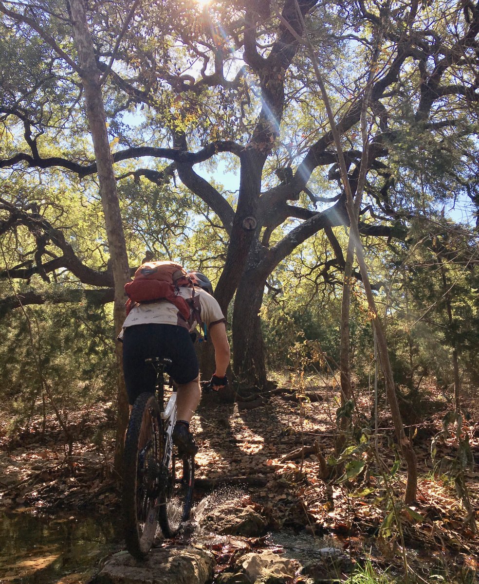
From today's ride at Brushy Creek.
-
5
-
-
9 hours ago, eloteman187 said:
Other than .6 and log loops, good for this evening?
If you end up riding this evening, could you please post an accurate report of the trail conditions? Maybe point out what to avoid? Thanks!
-
Are there any weekday-evening trail work dates coming up at Walnut?
-
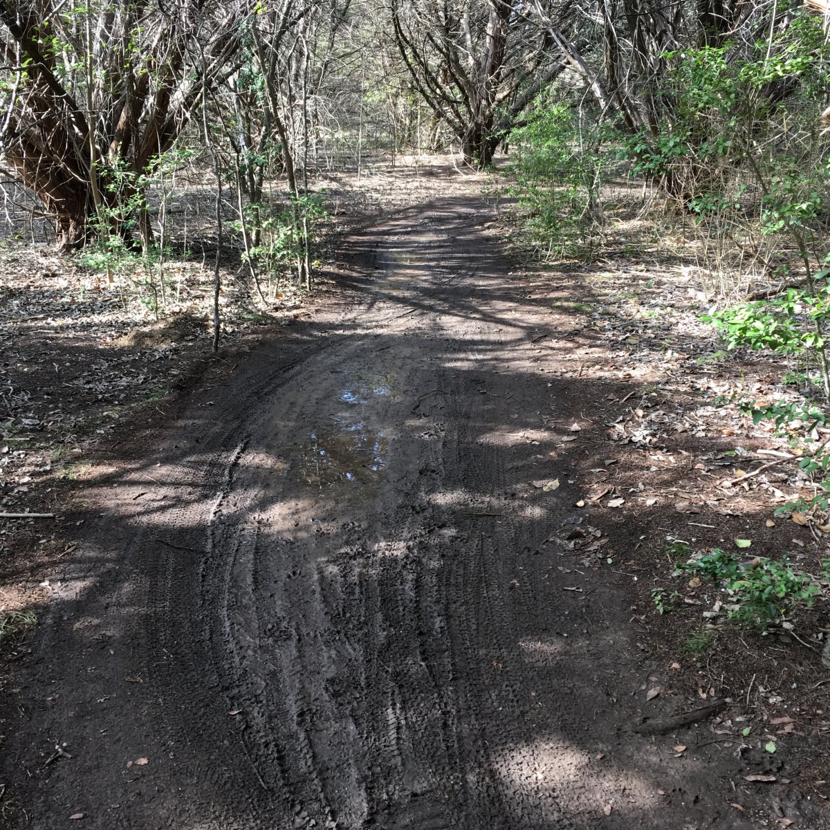
While I was at Walnut today, I drained the swamp that had accumulated in the big roller just below the log-pile in Mark's Art. You can imagine the deep rutting that was developing on the exit side.
.thumb.JPG.02fa3f0e6935d76766c8c37cff033795.JPG)
-
 1
1
-
-
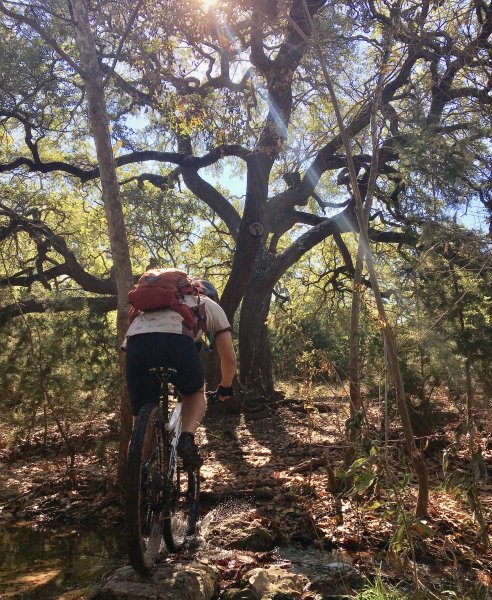
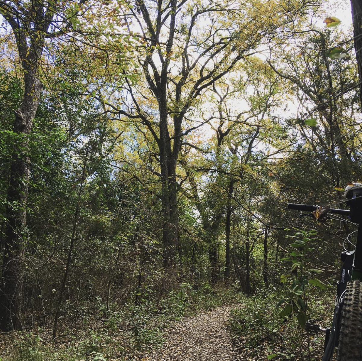
Local. Today. Was so pretty I had to stop and take the shot.
-
3
-
-
On 9/22/2018 at 4:04 PM, TheX said:
My mom on Midway Island in '60.

I was on Midway Island in the mid 60s. Only one square mile in size, so everyone had to ride bikes--except the CO, of course.
-
1
-
-
On 9/18/2018 at 6:45 AM, JRA said:
Back 40

That trail looks super fun!
-
1
-
-
Sounds fun! I need to make it up there...
-
1
-
-
Nice! Looks like they've had some rain, too.
-
On 10/13/2018 at 5:52 PM, CopeIt said:
Sorry guys, I'm getting back into mountain biking and got a new bike. This month of rain is on me.
Sent from my Pixel 2 using Tapatalk
I’m pretty sure there’s a law against mentioning a new bike and not including a pic...
-
I led a group on race practice. We just needed a short loop for time-trial style laps. Used outer log loop and the new up/down trails that replaced power line hill. I wanted to use .6, but thought it was too muddy in the usual spots. Same with inner log loop. Afraid that’s all I looked at.
Wouldn’t mind hearing about other specific loops that are really too muddy, still. Thanks.
-
I’m surprised they held the ARR ride. Here’s the inner log loop at 8a, when I did a trail-run reconnaissance to determine which trails to use for a noon training session. Or maybe they skipped the muddy loops?

-
I prefer to cross Braker at the north entrance to the Pickle Campus. I don't trust the cars going north on Mopac frontage and making the turn onto Braker. There is no stop built into their flow, since they have a protected lane.
Once you cross Braker, if you skirt the Domain along the perimeter on the south and west sides, stop signs and traffic are minimal. Stay along the fence to go under Mopac, then turn north to head up to Duval on the sidewalk that runs in front of Nat'l Instruments.
That's probably not as efficient as the straight-along-Mopac-frontage option, but I'm not a big fan of riding so close to all those cars. Looking forward to the paved path being completed between the tracks and the soccer fields. It'll make for cleaner commuting!
-
Anyone have any info on current trail conditions at Walnut?
-
This will be a better site if females and their body parts are not constantly used as standard vocabulary when the intent is to insult someone.
Thank you, Albert.
-
7
-


.JPG.4542a3720b2c8e9dd4f97496cd0aadcd.JPG)


Brushy Creek
in Mountain Biking Discussion
Posted
Actually, we didn't see any barriers when we went back by around 5p. The workers were gone. I guess he didn't learn his lesson the first time...