
cxagent
-
Posts
609 -
Joined
-
Last visited
-
Days Won
28
Content Type
Profiles
Forums
Gallery
Calendar
Posts posted by cxagent
-
-
There is a meeting Thursday afternoon (10/11/2018) for them to "explain it to us". I have not looked any farther ahead than that. There will be at least 2 public meetings I know of and chances for public comment. The actual approval by the Coordinating Committee will in December, I think the afternoon of 12/5/2018 at City Hall. Those will be posted later.
I am trying to keep an open mind about this revision. OHHHMMMMMMM
-
So it was pointed out to me that the 2007 Tier III Land Management Plan for City Park does not include a map. You can find a copy of the 1999 Tier III Land Management Plan map at - https://www.dropbox.com/s/lj924svmbufuqvd/1999 Tier III Land Mgt. Plan Emma Long Park Map.pdf?dl=0
-
7 hours ago, TAF said:
Some potentially dangerous language: "Redefined public access may be proposed for hiking, hiking with dogs on leash, running, and mountain biking as provided for in the COA BCP Trail Master Plan"
Also, under 3.1.4: "Existing approved trails (*see maps in Tier III plans for locations) exhibiting significant erosion must be closed or renovated and restored to habitat. All
non-approved trails are subject to closure and restoration." Need to go find these Tier III plans …Most of them can be found by Googling "balcones canyonlands preserve tier III" Make sure you include the word "preserve" or most of what comes up is related to the Balcones Canyonlands National Wildlife Refuge not the preserve.
The most controversial Tier III Land Management Plan (City Park) can be found at - https://www.dropbox.com/s/wlh06thmux088gi/Tier III City of Austin Emma Long 2007.pdf?dl=0 That one has moved and changed at inopportune times so I keep a stable version of it.
-
The Balcones Canyonlands Preserve has released a new draft of the Public Access chapter of their Land Management Plan. I put a copy of the draft on my Dropbox Public folder for people to see - https://www.dropbox.com/s/wfvbwo9gfui8ht0/20181008update%20Public%20Access.pdf?dl=0
The previously adopted version (1999) is also on my Dropbox folder at https://www.dropbox.com/s/7atz72l352mxk3u/1999%20Tier%20IIA%20Public%20Access%20Chapter.pdf?dl=0
I will be reviewing it and making a list of comments. I don’t want to say anything about it until I have had a chance to digest it and make sure I fully understand it. I hope other can take the time to plow thru it.
-
 1
1
-
-
19 hours ago, Seths Pool said:
sign a waiver, and come help either dig or contribute to the trails in some way, and id be happy to show you the place 🙂
Those FR512 guys are too cool. This is how things should work.
-
1
-
-
On 10/2/2018 at 8:36 AM, Seths Pool said:
its because one guy is a total ass hat and apparently doesnt like the idea of seeing mountain bikers enter a trail system NEXT to his property
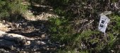
Two words. Two words I say - Game Camera.
I have been amazed how stories have changed when there was actual proof.
-
I agree with the recommendation to find the helmet that fits your head over anything recommended by others. However, I don't think closing the thread or any other 'request for recommendation' threads. I for one don't want to have to try EVERYTHING on the market to see what works for other and myself. In addition to differences in body shape, there are differences in riding styles, tastes and such. Take preferences for different tires. I like the Ardent and Nevegal tires. Others don't like them. I'm not going to try every different tire so I listen to what other people like and don't like.
I find that Bell and Fox helmets fit my head best. I have been using Fox Flux helmets for the last several year. I changed from the Bell helmets to get the better coverage on the lower back of my head. That said, I have Giro Montaro MIPS sitting on my desk. My wife bought it for me but I have not taken out of the box yet. We bought it after I tried on many many helmets.
-
On 9/28/2018 at 1:34 PM, mack_turtle said:
Does any part of SATN have trail stewards?
Yes - parts of SATN has Trail Stewards.
-
On 9/28/2018 at 8:12 PM, MrMentallo said:
Don't hate. Here's my trail maintenance set up. I tend to bring too many tools.
.jpg.5fd9507bbd4df28b21f3965f7b155063.jpg)
I think I saw you on the trail the other day. Was that you going down the Hill of Life? All I could see was the blur and dust as you went by.
Or maybe that was a hallucination as I was climbing the HOL.
-
1
-
-
Thanks to everyone who came out to help. Especially to The Tip who volunteered as a crew lead. We had about 50 volunteers. The Camacho mountain bike team even volunteers to help built this new trail.
There will be more work days in the near future. We know people are busy and can only volunteer a limited time. Still every bit helps. We got a TON of work done on this new trail.
-
2
-
-
On 9/18/2018 at 11:54 AM, DrunkyDrewster said:
Is it ok to volunteer but leave a little before 1pm? I'm volunteering at the Texas Craft Brewers Festival from 1-4pm.
Absolutely! You are volunteering so you can arrive or leave anytime that works for you. I hope you can make it.
-
Great link RF! I didn't know the info was so readily available.
Mack - my experience is that no matter what you do, SOMEBODY will complain. But most people will understand and may even approve if you have armored the trail to correct a low/muddy spot. I suggest using the largest rock you can. They tend to stay in place with traffic and water flow. Make sure you anchor the rocks well.
-
There is a homeless camp near the entrance to Outer Log Loops. The guy is acting like a real nut job. No - he is not screaming MMMMIIIIKKKKEEEE but is is claiming he is the "son of God" and for you to get off his lawn. OK, I made the lawn part up.
The City has been notified. They plan to have him removed on Thursday. While he is still there I suggest people stay in groups as they pass his tent.
-
It looks like we may have up to 100 volunteers. So now I am desperate for crew leads. About 10 people on a crew is the limit. So I need at least 10 crew leads. I have 5 and need 5 more.
I have 25% off $200+ or 20% of <$200 coupons from REI for anybody who will volunteer for a crew lead.
-
There are a few muddy spots still - but most of Walnut is ready to ride as of this evening.
-
1
-
-
I rode much of Walnut tonight. I was shocked at how good the trails were. There were a few mud spots but nothing I could not ride around. I formed no ruts and picked up very little dirt on my tires.
My wife and I thought we would ride the 'big sidewalk' with a few offshoots on the trail. Once we started on the trail we found most of it was in very rideable condition. Point 6 (usually one of the last to dry) had two muddy spots but the rest was good. It was easy to ride around those two spots and stay on the trail. Log Loops (both Inner and Outer) were good. Even Tar Branch Crossing was rideable. The creek crossings had water in them so if too many people ride across the leaving side of the creek will get a bit slick. We did not check Windy Loop or BMX Loop.
I cleared the tree limbs just south of the Rock Bridge. CharDog will clear a lot more during the work day on Saturday.
-
2
-
-
On 9/15/2018 at 10:13 AM, Albert said:
I agree with regards to Burro Pass. Last time I was there, I think mid-October or late September, and it was already freezing up at the pass. Late October seems pretty unlikely. And, anyway, there are plenty of other trails at Moab I've never ridden, and I'll get back to the The Whole Enchilada at a future date. 🙂
Thanks for your offer to loan me maps. I'm not planning to be back until October 27th, so that may not work out. Thanks also for the list of locations to consider!
..Al
You are correct - our schedules will not mesh.
I will scan in some of the better maps and send the files. The maps of Moab trails are not needed during the ride due to the great signage on the trails. But the maps give a good way to plan which trails you want to ride. And due to different skill level on most of my rides there - a way to plan where to meet up when one group takes the "easy route" and one group takes the "challenge route".
You can find a lot of trail maps on line. For example I would have sent you a Palo Duro trail map. But you can download it at https://tpwd.texas.gov/publications/pwdpubs/media/park_maps/pwd_mp_p4506_0007p.pdf And dont forget to check *BOTH* MTB Project and Trailforks. They both seem to have trails the other on does not.
-
Chances of Burro Pass being open are slim. In 4 trips to Moab I have yet to get to ride Porcupine from the very top. Burro Pass was only open for one day on two different trips. Of course I planned to ride it the next day and it was closed.
The wife and I drive to Moab and stop many places along the way to ride and break up the drive. I have a ton of maps I will share as long as you return them before we start our next trip in late October.
Some general locations we have stopped to ride
Palo Duro Tx - tons of trails, we have barely scratched the surface due to heat, rain and races on the trail
Taos NM - good riding near town best riding in the mountain above. South Boundary Trail and trails across from the ski area
Durango CO - too many to list check with local bike shop
Phil's World Cortez CO - on my MUST ride when passing thru
Moab - Too many to list but I have 10 - 15 maps. Don't forget there are shuttles to the more distant trails
Grand Junction CO
Fruita CO
Breckenridge CO
Frisco / Dillon / Silverthorne CO
Denver / Boulder CO (mountains just west)
Salida CO - never stopped there but hear good things
-
1
-
-
I will agree that is a hot mtb chick in a tutu. But I will NEVER believe that is Walnut Creek or the R&I.
-
10 hours ago, Schrute said:
... But the best way to face crazy is with more crazy.
Sent from my SM-G900P using Tapatalk
Please, please PLEASE do not go crazy on someone - even a crazy person - if you are on a bike or wearing biking gear. You have no idea how much time I spend trying to smooth over things like that.
But I suspect that if this guy had responded in kind her story would have been that he physically attacked her. And the police would have believed the woman who claimed she was attacked over the man that said he did nothing wrong. Just look at anytime the police are called about a domestic dispute.
I actually thought this guy handled it pretty well. Although if I had been in his place I would have put my phone in my pocket and let her tell the police that I tried to run over her. Only after she made a false police report would I have shown the video. Yeah, I can be vindictive that way. Some funny idea I have about people taking responsibility for their actions.
-
1
-
-
If someone tries to "redefine" a word that already has a meaning - expect trouble.
Maybe I should bring my "enduro bike" to one of those trails. Yeah, the one with a real motor. Not some old crappy quarter of a horsepower thing (me).
-
7 hours ago, TAF said:
I'm always happy to stand corrected - especially by those fortunate enough to have been around in the day - but I do maintain that the larger motorcycles do cause damage out there. I was out there one Thanksgiving day a few years ago - not something I'd recommend, btw - and it was busy with motos. One guy in particular had a massive 650cc motocross bike. The rider wasn't that skilled, so we kept passing one another. Unlike the lighter motos of yore, he would just ram it into the ledges to climb them. Rock was flying everywhere, and the divots when he cornered were 12 inches deep or more. It's really never been the same since, especially after rain.
I agree with you the "enduro" motorcycles can cause a lot of damage to the trail. The trials motorcycle are probably similar in trail damage to hiking or MTBs. Those motorcycles are very light weight, very low tire pressure (10 - 12 PSI) and almost never spin or skid their tires.
And the less skilled the rider of anything, the more damage is likely. Even MTB riders who cannot ride the trail cause damage by creating a bypass.
-
20 hours ago, Kobra Kai MTB Guy said:
Speaking of Emma Long....
I only do the main loop when I'm out there. Any pointers on other cool spots to hit?
Pretty much the Main Loop is the MTB trail. There is also a "two way" trail that connect the east side to the west side of the Main Loop (Katzwalk). There is a "kids loop" south of the parking lot and few short connector trails scattered about. You can see all of the legal trails on the map posted in the kiosk by the picnic shelter. That should be the same map that is at https://www.austintexas.gov/sites/default/files/files/Parks/GIS/EmmaLongKioskMap_Motorcycle.pdf
-
Details
• Trail work on the Country Club Creek Greenbelt at 3199 S Pleasant Valley (dead end south of Oltorf) . This is a new trail near downtown Austin. There will be about 4 miles of trail when it is done.
What we'll do
We will be building new trail. Trail has been flagged and needs to be cleared. If there are enough volunteers we will also be cleaning up trash.
We will be doing tread work and armoring the tread. There will be some people cutting weeds / tree limbs. Wear closed toes shoes and work / weather appropriate clothes. Children are OK with parental supervision. There is poison ivy and mosquito everywhere so cover up if you are allergic.
We are scheduling lots of workdays so racers can start their 2019 Paydirt hours early. Don't get caught by next year's deadline.
• What to bring
Bring gloves and water (Camelbak or water bottle). ARR will provide tools (wheelbarrow, saws, loppers, shovels, etc.) and some gloves. Bring your own tools if you prefer your own. Bring your Pay Dirt form if you need Pay Dirt hours.
• Important to know
This is a new trail and needs lots of work just to clear the corridor.
The Austin Ridge Riders is YOUR local not-for-profit IMBA Chapter. ARR builds and maintains the sweet singletrack we all enjoy. If you are not yet a member of ARR, SIGN UP TODAY! http://www.austinridgeriders.com/membership/
To get credit for pay dirt, you need to download and fill out the form. Bring it with you to have the ARR Trail Crew leader sign. http://www.austinridgeriders.com/wp-content/uploads/2017/03/paydirtform.pdfhere.-
1
-
New BCP Public Access Land Management Plan Released
in Mountain Biking Discussion
Posted · Edited by cxagent
Met with the BCP staff today. It was the most productive meeting so far. The meeting was dominated by the Emma Long motorcycle guys. We didn't get a lot of discussion of mountain biking or other areas. Staff appeared to want to work with us but also wanted to be clear that there were limits to what they could change. Obviously they can't allow the public to run wild on the Preserve. But we users can't allow the existing park lands that were put in the BCP to be closed. There is a lot of room to work between those extremes.
The draft document is in the link above and also posted on the Travis County BCCP web site at https://www.traviscountytx.gov/tnr/bccp (I verified that URL took me right to it.)
There is public review meeting from 6:00 PM to 7:30 PM on 10/24/2018. The location will be announced later. (They are trying to figure how large a space they need.) My best guess is the location will be at 1183 Chestnut Ave.
October 30 there will be a Citizens Advisory Committee at Reicher Ranch (near Lakeway Home Depot). You can provide comments during the Citizens Communications but comments are limited to 3 minutes.
Between now and 11/7/2018 at 5:00 PM you can email comments to BCCPSecretary@austintexas.gov I heard they would set up a Survey Monkey to collect comments but I don't find that link anywhere.
Mid November, they will post an updated draft to include comments. This draft will be submitted to the BCCP Coordinating Committee
December 7 2018 from 1 to 3 PM the BCCP Coordinating Committee will meet at City Hall (165 Guadalupe). Citizen Communication will allow comments also limited to 3 minutes each. The idea is to approve the draft at this meeting. So comments at that time will only be request to approve or request to reject.
There is a lot of review and comment work to be done if we want to make any improvements.