cxagent
-
Posts
609 -
Joined
-
Last visited
-
Days Won
28
Content Type
Profiles
Forums
Gallery
Calendar
Everything posted by cxagent
-

Austin Ridge Riders... FR512...
cxagent replied to RidingAgain's topic in Mountain Biking Discussion
WOO HOO! I did not know that. To my knowledge this is the only place that ARR gets any credit. OK, there is one other place where the local manager decided to 'let something sneak in'. As I mentioned on a different post, I try to stay out of the way on BC. You guys have it under control. I need to spend time in other areas. -
The book I posted was written and produced by a local MTB rider. He may have been part of a group that produced other areas but I don't know. I met him a year or two ago when he donated a bunch of cinder block to ARR. He said he still has his bike and wanted to start riding again. I hope he does. BTW - I have a copy of a similar book about trails near Moab. My wife calls it the "Liar Mel" book. She and a riding buddy did a ride in Castle Valley while the rest of the group rode Porcupine Rim. They got lost. And then they got lost again. And then they got lost some more. Not to say Mel's book is bad - but there is only so much that can be shared in a one page description of the ~30 mile trail. And when the book says to turn at the sign for the camp, she did not expect to be looking for a 3" x 3" picture of a tent on a Carsonite post. Fortunately I had given her a Garmin with maps in it. They finally made it out at sun down when at the time I was starting to ride backwards with lights in hope of finding them. To tell you how desperate this was I had gone metal to metal on my rear brake at the top of Porcupine. I still had no rear brake on my bike. I was not going to allow anybody to ride with me so I could move faster. And because I had 'borrowed' all of the batteries for lights. I expected to be out all night looking for them.
-
Austin Ridge Riders... FR512...
cxagent replied to RidingAgain's topic in Mountain Biking Discussion
It was a 60% IMBA / 40% ARR split. But I think that changed this year to 50/50. I think it was ~4 years ago that ARR decided to become and IMBA chapter. Before that 100% went to ARR but ARR had to provide a lot of "overhead" now covered by IMBA. There are still discussions about if the sharing is worth it to ARR. So far, the result is that it is worthwhile to both even at the 60/40 split. -
Austin Ridge Riders... FR512...
cxagent replied to RidingAgain's topic in Mountain Biking Discussion
throet - there are still two ARR Board positions still open. We had to go begging to fill three of the five that were open. All help is appreciated. Many of your ideas have been discussed. Clearly they have not been implemented. For example, we tried to post signs at ARR maintained trails. Signs as simple and innocuous as "Maintained by Austin Ridge Riders" at the bottom of the sign. Even on the LCRA signs where ARR was providing 100% of the cost - the land owner rejected any ARR name on any sign. Parks and Rec had similar direction. It is not that your ideas are not good ideas. It is there are limits that ARR has to live with. Like following the land owner permission. As far as the $50,000 income per year - that is the threshold where a tax return is required to be filed. Below that threshold the "tax return" is a form saying we did not have that much income. ARR has not had the "problem" of filing that tax return. -
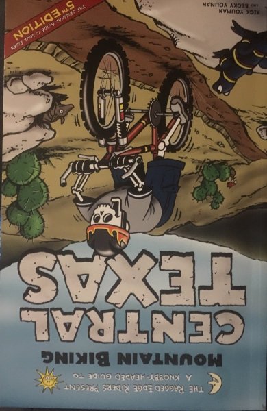
I thought you were talking about this book. But Forest Ridge and Rifle Range are not in there. And I don't think ARR had anything to do with this book. I would love to see that book if you can find it. Sorry the image is upside down. I have no clue how to fix it. I rotated the image in Paint and reloaded it, but it still comes back in upside down.
-
ALL trail maps are useful. The SOS map would not document grandfathered trails (before BCP in 1996). But it clearly documents the hypocrisy of one group (MTB) being not allowed while another group (SOS) selling maps to those same trails. BCP generally decides what they want to recognize based on some undefined logic - maybe a Magic Eight Ball or rolling dice. We pulled a map out of the 1999 BCP land management plan that they chose to not recognize. Yes - that was their document. They had a different map they liked better so they recognized it instead.
-
Austin Ridge Riders... FR512...
cxagent replied to RidingAgain's topic in Mountain Biking Discussion
I will try to answer some of throet's questions in the few minutes I have - ARR is 100% volunteer. NOBODY is being paid. 100% of membership revenue and donations go to building / maintaining trail, trail building tools, club costs like the tool storage shed, etc. NOBODY is paid for their work. The number of memberships varies from month to month. Typically it is in the 400 to 500 range. The number of local mountain bikers is really hard to define. The best documented info I find is the number of people on Meetup is about 4500. So in round numbers ARR membership is about 10% to maybe 15% of the Austin mountain bikers. I know a lot of people I have ridden with are not ARR members. That is their choice. I hope they see the value in what we do for them but it is always their choice to join. There was a question about IMBA's position in MTB ban in wilderness areas. I really don't understand the position they took. I would have fought it but that is my personal opinion. But since Texas has very little wilderness area I don't see it as much of an impact on ARR. Several if not most bike shops support ARR when they can. Things like donations for Pace Bend Race, Cranksgiving and Ride Like A Girl. Once a year the Pace Bend Race gets a "Title Sponsor". Years ago it was consistently BSS. More recently Chumba has been the Title Sponsor. Recognize that the current economics of most people buying online instead of locally really limits what the bike shops can do. We greatly appreciate any and all help. Local governments rarely provide money. Most of the time, governments are short staffed and short budgeted so they really don't have the option of providing money. If they can provide anything it is usually donating staff time / labor to support cleanup and trail building efforts. All donations are greatly appreciated. I need to quit typing and go ride. But it is too wet to ride. People have their opinions and nothing seems to change those opinions. Some recent "discussions" makes it clear to me that most people quit listening after 10 to 15 seconds. Everything needs to be a "sound bite". But since this too far into this post for people to read - I might as well be saying blah blah blah tiddle de winks bulls hit. -
Does anybody have a copy of the trail map the SOS (Save Our Springs) sold a few years (4 or 5?) back that showed most of the trails in the BCGB? I can't find mine. I was looking for it to post in answer to crazyt's post.
-
Not sure I understand what you are looking for. I recommend sending a private message to Chardog on this board. He is the man with a plan.
- 1 reply
-
- 1
-

-
Austin Ridge Riders... FR512...
cxagent replied to RidingAgain's topic in Mountain Biking Discussion
The time it takes for me to type all of this and the usual results mean I spend my time elsewhere. Like on the trail. Hopefully riding the trail but usually building or maintaining. -
Austin Ridge Riders... FR512...
cxagent replied to RidingAgain's topic in Mountain Biking Discussion
And after years of having and using Facebook - I have deleted my Facebook account. I have no intention of ever going back. -
Austin Ridge Riders... FR512...
cxagent replied to RidingAgain's topic in Mountain Biking Discussion
To throet's posts (not quoted here because only a small part is my area) - ARR is promoting mountain biking and mountain biking education anywhere and everywhere possible. But those are other peoples' areas. Trails are my area. My goal for ARR trails is to have mountain biking trails (natural surface, mostly single track) in as many places and areas as possible. We need trails for all ages and abilities including beginner to very advanced. The trails need to be mapped and signed so riders can find them, ride appropriate trails for their skills, and navigate to where they want to go. Not all trails are appropriate for all riders. The trails need to be "sanctioned" by the land owner / land manager so that mountain bikers are not stuck building trails and then forced off of those trails as more numerous / powerful / vocal groups decide they want those trails so the mountain bikers need to be banned. Have you heard there is a regular push to ban mountain bikers from Walnut Creek? Barton Creek? Just about every trail I know of? The relationship we have built with the land owner / land manager is the only thing that keeps us from being banned. Some people have an opinion of mountain bikers that is along the lines of the Banditos motorcycle gang. And to build a good reputation for mountain bikers, we need to educate riders how to deal with other trail users and especially how to deal with the trail feature they don't like. (see my post about Pace Bend tree cutting.) Recent events you might not have heard about - LCRA opened 4 new LCRA parks to mtb. One of them - Pedernales River Nature Park - is so short and flat it can only be considered a beginner trail such a long drive from Austin that I don't predict much use. The other three (McKinney Roughs, Grelle and Shaffer Bend) have HUGE potential. Currently, they are jeep and horse trails that allow MTB. But we are discussing where / how / when to build MTB specific trails. I predict these may be as big a draw as Pace Bend. But each trail will take a long time and lot of effort to change into a destination type trail. After over 5 years of constant nagging, I finally got approval from the City for ARR to maintain the main trail in Barton Creek. OK, we can only do trail work outside of nesting season, but we can at least do trail work 6 months out of the year. Until we got this approval I have to call the City about each and every problem. Then let them figure out they could not find or handle it. Then 2 to 6 months later - go fix the problem myself. ARR got approval to replace the trails at Walnut Creek that were destroyed by the big sidewalk ( I hate to call it an "Urban Trail"). Powerline Flow Trail, Ski Hill Flow Trail, etc. were the result. We had to close the old trails that were conflicting with the big side walk so we tried to make trails that were more fun than the old trails. We built a Kid's Trail in Guerrero Park. It has been temporarily closed by neighborhood complaints. But PARD has said they want to and will work with us to open it again. That may take a while. Governments move s l o w l y. ARR is currently building a new trail in Country Club Creek Greenbelt (see Chardog's post about a work day and my correction). It will be about 4 miles of 'Walnut level' trail that can be ridden to/from by somebody living near downtown or doing an urban ride. Planning has started for a trail along Williamson Creek across all of south Austin. When completed, it will connect Oak Hill in the west to Onion Creek in the east. It will also connect to the "Big Loop" that is planned and being built around all of north Austin but does not (yet) cross the river. This will never be a technical trail. The terrain just is not there. But there may be some technical spots. And it will connect to the Violet Crown Trail which connects the Greenbelt, which connects to ... everything. Speaking of South Austin - ARR is working on getting large sections of the SATN recognized. It will take a while. Did I mention that governments move slowly??? Edited to add - I can't believe I typed all of this and forgot the biggest one - https://austinmountainbiking.com/index.php?/topic/234-new-bcp-public-access-land-management-plan-released/& I won't spend the time typing all ARR does to maintain and keep open the existing sanctioned trails. Let's just say that is a full time job by itself. And much of that effort is working with Land Managers to solve their problems so MTB is recognized as a legitimate and desirable trail user. Anybody seen the Main Creek Crossing or Tar Branch Crossing at Walnut Creek? Yes I rode them before the erosion ditched were filled and I ride them afterwards. But those erosion ditches were problems the land manager needed fixed and did not have a way to fix them. ARR stepped in and solved those problems. So the next time the 'off-leash dog people' complained about the mountain bikers - the land manager defended us. I have not heard they complained again. 😉 -
Austin Ridge Riders... FR512...
cxagent replied to RidingAgain's topic in Mountain Biking Discussion
Note in my earlier post I did not say BC was built by ARR. Brushy Creek trails were started as bandit trails. I rode them and loved them then. About the time that I started with ARR, Wilco had found and was "looking into" those trails. (notes on the trail about call this phone number.) ARR was asked to be the recognized organization (legal organized, insured, etc.). ARR accepted that responsibility so the trails could be officially recognized by the land owner / land manager. ARR / I have both worked with the OG and tried to stay out of their way. They are doing great things so unless they got way off the tracks, I thought it was better to stay out of the way. ARR has provided some of the tools, funding, etc. for some but not all of the work done since ARR getting involved. I don't know of any trail that riders have not provided their own time, tools, money, etc to build trails. BC is no exception. Differences - I am sure of it. But any two people will have differences of opinion. I think we have worked thru any differences. Animosity??? I hope not. I thought we had and still have a good working relationship. Would BC be what it is today if it had followed the ARR approach of getting land owner approval first? I have to say I doubt it. When a land owner is given the choice up front like ARR does, they usually go with the 'less risky' approach of start with the less risky stuff and allow more difficult / advanced trail features only after the less risky is shown to not cause trouble. It can take years to convince risk adverse land managers to allow more advanced trail features. Conversely, bandit trails can be built and proven to be acceptable before the land owner objects. But ARR still asks and gets approval before building trails. ARR gets the blame and has to handle many many bandit trail / land owner issues every year. We don't want to start being the rogue organization that can't be trusted. I hope that helps. -
Austin Ridge Riders... FR512...
cxagent replied to RidingAgain's topic in Mountain Biking Discussion
It is easy to misinterpret what someone posts. I have had MANY of my posts cause trouble because my wording was not clear. What crazyt did say was "Freeride 512 supports freeride trails (you can look up the definitions). Most riders are XC as it is easier." The "new riders", "beginner" and "wheelchair ramps" have been said directly to me (not typed) by others outside of this thread / board. That makes me think it is such a common perception that people think it is not insulting to describe someone's volunteer work in those terms. Maybe I am too sensitive. Maybe they should walk a mile in my shoes. Or ride 50 miles on my ride. -
Austin Ridge Riders... FR512...
cxagent replied to RidingAgain's topic in Mountain Biking Discussion
I think Chardog meant to post this work day for his second event - -
Austin Ridge Riders... FR512...
cxagent replied to RidingAgain's topic in Mountain Biking Discussion
Consider this to be one person's opinion - NOT the position of ARR as an organization. ARR builds and maintains trails according to what the land owner / land manager will allow. Add to that the ARR insurance has limits on what can be built or allowed. Since most of the ARR built trails are on public lands and the land manager is required to allow the public at large to use them - they tend to be "less advanced" trails because the land manager is concerned about Mr No Helmet Never Been On A Bike Before He Stopped At Walmart Today. Beginner trails, easy trails and even as I have told lately "wheel chair ramps" are not what ARR wants to build and maintain. But it is what is allowed in some locations by the land managers. So what would you pick - build and maintain trails that are allowed or not build "easy" trails to raise ARR's reputation? ARR has chosen building trails over the ARR reputation. I agree with that. And the land manager have a good point. Has anyone heard the screaming, bitching and moaning about how "dangerous" the Pace Bend TMBRA race is. My wife calls Pace Bend her favorite trail. "Dangerous" my ass. She is not an aggressive rider. Has anybody ridden Lake Georgetown? I know, I know - beginner trail built by ARR. How about RPR? Oh yeah, wheel chair ramps built by ARR. Brushy Creek is an ARR trail that was built before ARR was involved but now ARR claims, supports and maintains it with the original builders. I could go on and on with the different trails that ARR has built and maintains. Anybody that has ridden with me knows what I like to ride. A lot of people walk the best sections I ride. And some people just don't even attempt those trails at all. But I have not been able to ride most of my favorite trails for the last 5 years due to "complications" if I was recognized riding on those trails. For some reason, I am fairly recognizable. Damn I miss riding those. But I gave up my riding because I thought I could make major improvements. But one point above is spot on. ARR caters to the new rider or the 'new to Austin' rider. Why? because that is what is requested the most. ARR tries to answer to what is requested. Someone who knows all the trails and has their usual riding group don't make requests. Typically, they don't even attend ARR rides or events. They have "moved on". So ARR gets the reputation of a "beginner group". That is not ARR's choice. ARR usually has an advanced or fast group at every ride. ARR tries to provide for every level of rider. I will get off my soap box now. -
I have seen similar situations in other areas. The guy that took me snow skiing for the first time quit show skiing when they started having kids. When it was over $1000 per day for lift tickets and rentals, they stopped. Another buddy raced dirt bikes (hare scrambles & enduros) for many years with his two kids. He also stopped when it became too expensive to maintain three bikes and pay three entrance fees and travel costs, etc. I am not saying anyone chose poorly or did it wrong. It is their decision as to what they want to do and if it is worth the cost to them.
-
I can confirm Angel Fire is free if you ride up. But two up/down runs was all I was good for in one day. The next day I paid for a lift ticket.
-
Put another way that is the same as 4 single day passes. One day a month for four months. Keep in mind that buying land, installing a lift, powering the lift, maintaining the whole place is expensive. And it all has to be paid with lift ticket revenue. Just curious since I'm not a golfer - what are green fees running these days??? How does a full day on the lift compare with a game of golf?
-
Anyone have a current update on Muleshoe bend?
cxagent replied to bestbike85's topic in Mountain Biking Discussion
As I have posted on other threads - The main loop is intended to be a beginner friendly (green circle) trail. Currently there are five rocky, punchy climbs that are not beginner friendly. We have built and marked bypasses for the first two of them. We hope to get the other three build and marked soon. Maybe in the spring. The worst case is someone has to walk about 100 feet at the three remaining spots. The side loops are the more challenging trails. Off the top of my head three are intermediate (blue square) and two are more difficult (black diamond). (Note I may have the count wrong as I may be confusing side loops with the bypasses. I have worked on a lot of other trails since I was last there.) The side loops are shown on the LCRA official map and marked with sign posts on the trail. -
This was in the email - snip - "Spider Mountain Bike Park offers year-round mountain biking, featuring beginner, intermediate, and advanced trails, all accessible via a four-person chairlift ride. The bike park features mountain bike and gear rentals, and will be open Fridays through Sundays starting Jan. 18, from 9am to 5pm, plus holidays and spring break. For additional details, visit SpiderMountain.com. Lift tickets are $50 for adults (ages 19-59) and $45 for all others. An introductory Spider Mountain Season Pass will be $199 for adults (ages 19-59 years) and $149 for all others, valid Jan. 19 through Apr. 30, 2019. Power Pass holders also have mountain bike privileges at Spider Mountain in addition to skiing and snowboarding in four different states. Power Cards and Power Packs may also be used at the bike park. With a variety of trails for all abilities and 350 feet of vertical, Spider Mountain’s lift-served bike park features include downhill flow trails, and technical trails with bridges, berms, jumps, and more. The bike park is designed and developed by Hogan Koesis, director of mountain biking for Mountain Capital Partners, which owns and operates Spider Mountain and six ski resorts. Koesis has more than a decade of experience in the biking industry, designing, developing and constructing trails."
-
Saw an email confirming that planned opening date.
-
Anyone have a current update on Muleshoe bend?
cxagent replied to bestbike85's topic in Mountain Biking Discussion
Pretty sure it is open now. Floods are no longer an issue. I would call ahead just in case there is a race or event that has closed the trail. https://www.lcra.org/parks/Pages/muleshoe-bend.aspx If Muleshoe is closed, jump over the Grelle - https://www.lcra.org/parks/Pages/grelle.aspx The trail is not as well developed for MTB but there is some good riding there. Download the map and just know it is a tough climb to get in/out but there are good trails on the other side. -
I agree that this thread is now beating a dead horse. This will be my final post to it. But there are still some things that need to be said - that is the reason for my final post. 1) I will contact RA when I have few minutes to spare. Good ideas come from everywhere. You don't know a good idea until you check it out. 2) We were building on the new trail at Country Club Creek Greenbelt yesterday (map attached). I intentionally left about an 8" diameter log across a part of the new trail and cleared an alternate line so people could go around it. This is supposed to be a beginner friendly trail so there needed to be an alternate line for even a curb sized log. And I wanted to have something interesting for more advanced riders. About an hour later I walk thru that spot. The log has been cut and removed. FML. It seems a hiker decided to "help". 3) I have posted this link several times but I think all of them were on the old Mojo site. If you look at the map at - https://austintexas.gov/sites/default/files/files/Parks/GIS/WalnutCreekMetroPark_LargeKiosk_Website.pdf you just might notice the Root Drop trail is a black line with black diamonds on it. The legend shows that marking means "Most Difficult". Most of that trail would be green if it didn't end in the Root Drop. Since the difficulty rating of a trail is supposed to be the rating of the most difficult part that can't be bypassed, that whole section is black diamond. PARD has not authorized any alternate line around the Root Drop. This map is posted at both the parking lot and Lincolnshire trail heads. 4) I am starting to think that trying to build trail for multiple skill levels is a fools game. So I think I will have a new "guideline" for future trail - If I can ride it without dabbing, it is too easy. I need to 'sketch it up' a bit. Let's see how much use those trails get. But I bet we don't get so much "help". CCCGB Trail Concept 2.pdf
-
I am listening. Show me what needs to be done. I take all good ideas and try to move them forward. Just be warned I don't make decision on a lot of things. The land manager does. I can only request / recommend. And I do a lot of that.


