Albert
-
Posts
1,126 -
Joined
-
Last visited
-
Days Won
27
Content Type
Profiles
Forums
Gallery
Calendar
Everything posted by Albert
-
Lake Georgetown (Goodwater Trail) Trail Conditions
Albert replied to Albert's topic in Trail Conditions
Wow, is that the dam at Lake Georgetown? Did they actually make a path there going partway through those rocks? I remember having to skirt along the left edge of them and it being a bit challenging!! I haven't been up that side in a long time. -
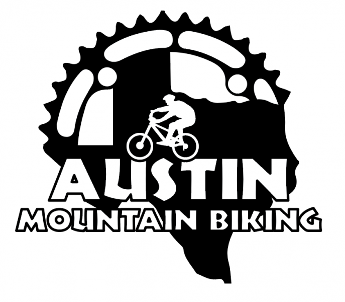
Thanks for the feedback Cody. Yeah, I'm not crazy about having "half" of Texas, but I do like the mountains on the upper half, even though we really only have hills here. But the sport is called "mountain biking". That 175th anniversary Austin logo doesn't do much for me, and its basically just another rendition of the state of Texas with some text and a banner overlaid on it. I wouldn't really want to lift that design directly, even if it is open source. It's harder to find something that is unique to Austin that would work well for the logo. Austin is the capital of Texas, and the state's shape is easily recognizable and unique, so I don't think it's out of place. Nothing is set in stone yet. 🙂 Thanks again, ..Al
-
More Trailwork at Lake Georgetown - Thursday, August 30th, 8AM
Albert replied to Albert's topic in Trail Work
DesertNomad won't be able to make it, so right now it might just be me. If you show up and there's nobody else besides me, we could both walk in. I know someone else cleared the first mile in from Cedar Breaks, so there's only another mile or so after that with potential trees down (I say "potential", as I am not clear exactly what we're going to find). I'll send you my phone number so you can text me in the morning if you're going to be there. ..Al -
More Trailwork at Lake Georgetown - Thursday, August 30th, 8AM
Albert replied to Albert's topic in Trail Work
The Austin Ridge Riders is a 501(c)3 organization, so any trail work sponsored by them would presumably fall into this category. -
I'm working with a designer to create a logo for the site. If you have a minute, please take a look at this poll and vote! Thanks!
-
Lake Georgetown (Goodwater Trail) Trail Conditions
Albert replied to Albert's topic in Trail Conditions
To make up for clearing the trees off the trail, we have installed more rocks. -
Man, I've never been out there, that even sure does look like fun. Looks like it's only an eight hour drive as well.
-
I have two possible logo designs for Austin Mountain Biking. They are similar, and I'm not sure which one I like best. These are not colorized yet, but wanted to get some feedback before we go further. Logo #1: Logo #2: Please vote for your favorite! You can leave comments about why you like/dislike the logos below. Thanks! ..Al

-
I have four bikes that I ride.. 29" Full Suspension Mountain Bike 29" Hard Tail Singlespeed Hybrid Cross Bike The cross bike is currently attached to a trainer that I use with Zwift. The full suspension mountain bike (Specialized Epic) I ride the most, followed by the hybrid, which I use on road/crushed granite trails. The Singlespeed I hadn't ridden in years, but started doing so again recently when the Epic was in for service after I destroyed my rear derailleur on Jedi recently. I'll probably ride that one on a regular basis now. I have an older (2007 or 2006) Specialized Stumpjumper FSR 26" and an even older Cannondale F800 I really need to get rid of before I consider getting another bike.
-
More Trailwork at Lake Georgetown - Thursday, August 30th, 8AM
Albert replied to Albert's topic in Trail Work
Hi Cody, Thanks for the feedback. I know someone else was out there this week and cleared some trees about a mile form Cedar Breaks heading towards Crockett Springs. I'm under the impression that the downed trees between Cedar Breaks and Crockett are not as bad as what you saw at and near Crockett Springs, but I haven't seen any photos outside of where we worked on Sunday. I guess we'll find out tomorrow, and I'll take some photos of whatever we encounter. 🙂 ..Al -
Lake Georgetown (Goodwater Trail) Trail Conditions
Albert replied to Albert's topic in Trail Conditions
There are two man-made bridges out there. Then there's that giant dam. That's not enough for you? 😄 -
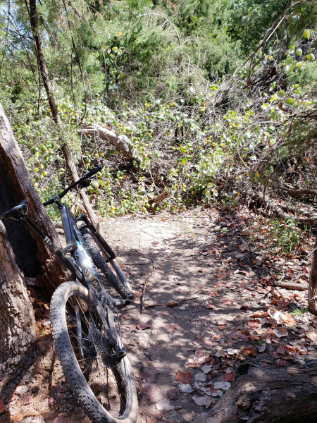
Apparently Gum Drop is completely blocked by a fallen tree, and someone said it wasn't passable. When I asked if it was not rideable or not passable, he posted this photo: That's one of the few trails we didn't ride last night (and is usually one I ride!), so this is good to know.
-
You're right, that does seem like a pretty stupid design decision. I think that's always how it's worked with Invision's forum software. It does seem ridiculous that they used the same icons at a different size that visually represent the same thing (shows you if there are new messages in those forums/threads), but the action is completely different. Let me think about that. I'm also going to see if I can hunt down any discussions about this very subject on their official support forum. ..Al
-
Great, thanks for the additional information!
-
Cool, thanks for the report. Do people just assemble into their own groups and head out to the trail?
-
South Austin Trail Network, The SATN
Albert replied to The Tip's topic in Mountain Biking Discussion
Done! -
This is a weekly Tuesday ride of the South Austin Trail Network, leaving from behind ATX Bikes at 6pm. Here's a map showing where to meet.
-
Rode Brushy Creek last night! Was hot as hell when we started at 6:45pm, but slowly cooled a bit. Was pleasant when we finished at 8:45 with lights. We rode, in this order, Peddler's Pass, Mulligan, Picnic (to very end), Up and Over, Rim Job, Snail, 1/4 Notch (backwards), and Peddler's again. Trails were in great shape, but obviously a bit dry! Okay, very dry. Even the creek crossings in Peddler's Pass were completely dry. https://www.strava.com/activities/1804397456 Hope to get out there Friday morning again.
-
Welcome to the forum! I just rode Brushy Creek last night, let me go post in that thread now!
-
If I didn't already have too many bikes, I'd certainly consider it. I have to sell/give away two bikes before I buy another!
-
South Austin Trail Network, The SATN
Albert replied to The Tip's topic in Mountain Biking Discussion
Thanks! I'll get out there for one of those rides soon, maybe next week. Can I add this ride to the calendar? -
How was the R&I last night? How many people typically show up? Ended up riding at Brushy Creek, which I hadn't done in a month. Need to get to one of these R&Is, as it's been some time now.
-
DesertNomad and I are going to head out to Lake Georgetown this Thursday, August 30th, to try and clear the remaining trees that are down between Cedar Breaks and Crockett Springs. We'll leave the Cedar Breaks trailhead at 8am on bikes, and keep riding west until we start hitting downed trees. We'll be using hand saws to clear any obstructions. Please join us if you can! Bring work gloves and saws if you have them, but we should have some extra saws that will fit in a pack. Make sure you bring plenty of water, as there will be no place to get water between Cedar Breaks and Crockett Springs. We'll be returning after we reach Crockett Springs (which is a bit over two miles in, so not that far, especially on bikes). Here's a map showing the location of the Cedar Breaks trailhead: https://www.google.com/maps/place/30°40'11.8"N+97°44'19.4"W/@30.669936,-97.740912,685m/data=!3m2!1e3!4b1!4m6!3m5!1s0x0:0x0!7e2!8m2!3d30.6699357!4d-97.7387176 If you have any questions, please don't hesitate to ask! ..Al
-
South Austin Trail Network, The SATN
Albert replied to The Tip's topic in Mountain Biking Discussion
There's a weekly ride out here, right? When and where do you meet up? Thanks! ..Al -
That's a nice looking bike, so much more travel than the Epic I'm currently riding.


