The Tip
-
Posts
1,058 -
Joined
-
Last visited
-
Days Won
50
Content Type
Profiles
Forums
Gallery
Calendar
Everything posted by The Tip
-
We're staying at Buescher SP Wednesday and Thursday night this week. What are the chances of the RHR trails being ok to ride either day?
-

Homeless Camps on BMX Loop at Walnut Creek
The Tip replied to June Bug's topic in Mountain Biking Discussion
Install the Austin 311 app. Take a picture of every camp every time and send it in right then, The more reports the better. The city IS removing camps, They just don't move as quickly as we would like of course. -
Hopefully no conflicts.
- 1 reply
-
- 1
-

-
Which of these trails do you ride the most?
The Tip replied to WhoAmI's topic in Mountain Biking Discussion
https://www.facebook.com/MaxwellTrail -
The Second Sign of the Apocalypse
The Tip replied to AustinBike's topic in Mountain Biking Discussion
Did anyone ever try to educate him? -
The Second Sign of the Apocalypse
The Tip replied to AustinBike's topic in Mountain Biking Discussion
Exactly. That is of course what it is for. Several people have observed what you have. The amazing thing to me is that the author of that article, that is merely reposting a viral video, is posting it in A BIKE MAGAZINE! Obviously that guy never does trail work. I give him a semi-pass though because lots more people watch "The Walking Dead" than do trail work. -
Rumor has it there is now a trail connection from the brewery to the Boggy Down trail. Pretty cool
-
Which of these trails do you ride the most?
The Tip replied to WhoAmI's topic in Mountain Biking Discussion
It is soon to be official. The stakeholders and the city officials have met and okayed the name to now be "Maxwell Trails". It will take awhile to be changed on all the different platforms. -
It's hard to miss the reroute and it is so minor it doesn't affect the recording of the Strava route. BTW, there are all sorts of sponsors for this. I don't know how much swag they are bringing but it's cool that Shimano, Giant, Santa Cruz, and Sram have all jumped on board. It's going to be fun
-
Dang, that's not good. Thanks for the heads up. All social media and schedules were scoured for conflicts prior to this date being picked. Oh well, more coordination in the future hopefully. I guess folks will have to decide if they want a single track mountain biking experience or an interesting road-dirt hybrid ride. Either way, winners all!
-
67 miles. Free. Fun. Shirts available. yada yada yada Detailed info: https://www.mtbatx.com/satnsocial2023
-
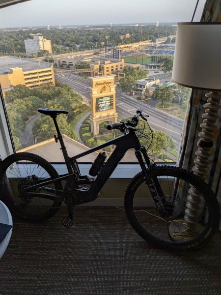
I tried another way. Posted another one from our hotel room in Biloxi too. Can these be seen? Expand the quote to see the new attempt

-
Thanks for the feedback. I am so techtarded!
-
I think other folks beat you to it. When did Mother Nature get so darn sensitive anyway? I still haven't found a really compelling reason why they are so bad. Even the individual National Parks themselves cannot agree on a policy.
-
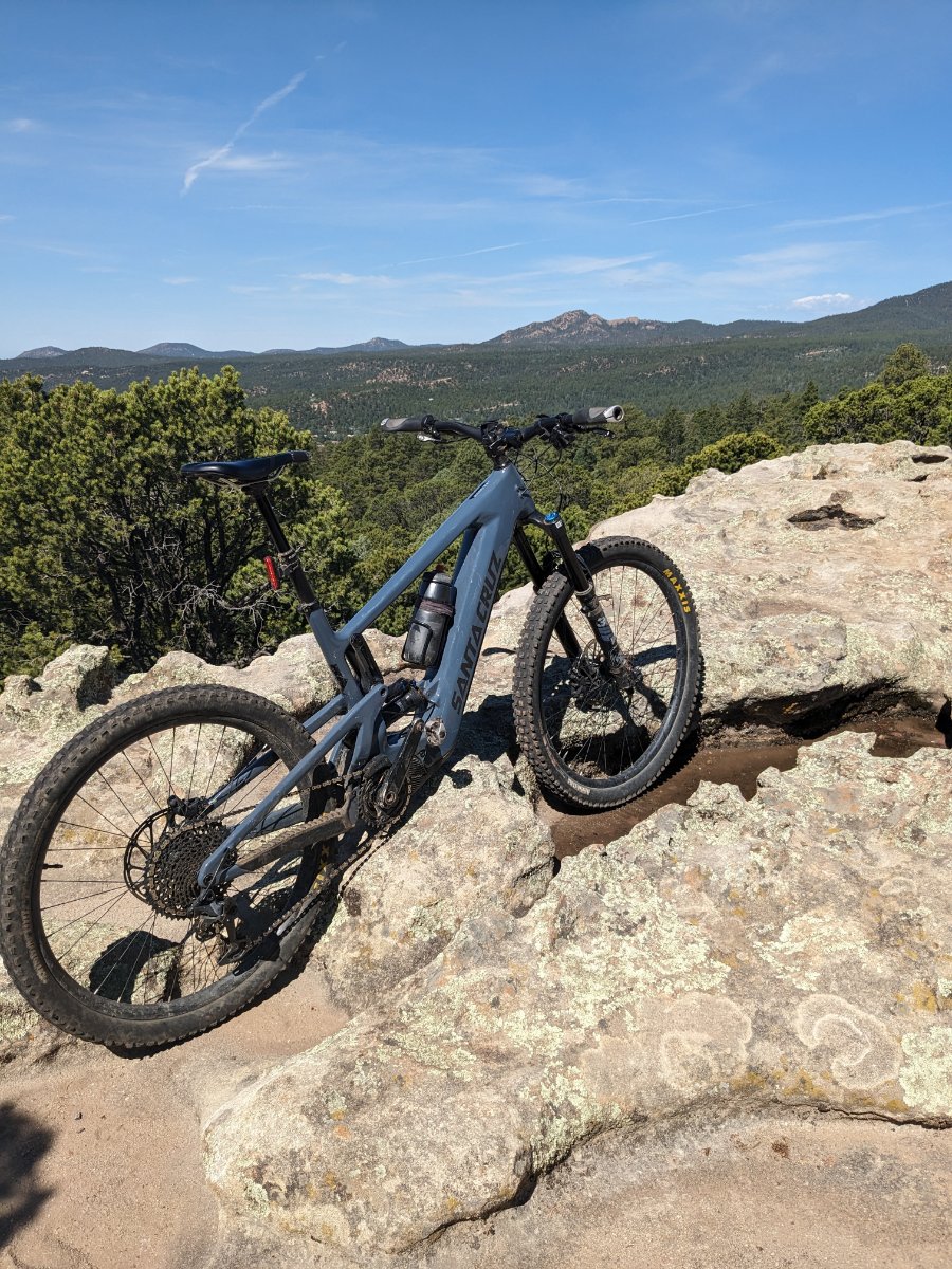
At the top of Cairn Me Up at Glorieta, NM (experimenting with a different way to post a picture. Hope it works) Trying yet ANOTHER way. We had to take our bikes to the room because the place we had to park was sketchy
-
What was the first trail you rode in Austin?
The Tip replied to WhoAmI's topic in Mountain Biking Discussion
I can't remember exactly when it was. 20 years at least. But it was after reading about maybe the third road biker getting killed or injured on 360 by a car. "I'm not riding road anymore!" I bought a rigid Trek at a pawn shop and started exploring the trails starting in Dick Nichols Park. Still ride them of course. There's a little bit more trail than there was back then. 😉 -
I drive to the ride when I a take the ice chest for post-ride dranking. I drive to the ride a lot. 😁 I also drive to the ride if I'm going somewhere far and exotic, like Walnut. But like Sluggo said, most of my SATN rides start about a block from my house.
-
I couldn't even see my own picture. sigh
-
The Second Sign of the Apocalypse
The Tip replied to AustinBike's topic in Mountain Biking Discussion
Epocalypse. Ha! They probably have been reading our Apocalypse threads all this time and came up with the name. We should sue -
South Austin Trail Network, The SATN
The Tip replied to The Tip's topic in Mountain Biking Discussion
If they develop that little sliver of land on the northeast corner of their tract, it will indeed impact the Danz Creek Cut Through. I can't imagine what they could do with it though, 25 acre lot. The "project site" is just in the middle. A church owned that piece before. But even if they put up a fence it won't be the end of the world. -
Two bike hitch rack cover suggestions please
The Tip replied to quixoft's topic in Mountain Biking Discussion
cardboardeaux -
Which of these trails do you ride the most?
The Tip replied to WhoAmI's topic in Mountain Biking Discussion
That might be another interesting poll to ask what trail app you use. I would guess the majority use Strava, then TrailForks. That guess is based on the small sampling of Crank and Drank riders. -
Which of these trails do you ride the most?
The Tip replied to WhoAmI's topic in Mountain Biking Discussion
It originally was called Slaughter Creek only, true. But now it's called Maxwell by those of us really in the know. This is to differentiate it from the multiple other trails in the SATN that are also named simply Slaughter Creek. There is a Slaughter Creek trail in Bauerle Ranch. There are the Slaughter Creek trails in Circle C park. And guess what the new multi-use trail in Mary Moore Searight is named? yup, "Slaughter Creek Trail Loop." And an irony about Maxwell Slaughter Creek is that you never see Slaughter Creek itself except at the entrance! I'm not sure what TrailForks you were looking at. But the one I just checked had it properly named: https://www.trailforks.com/trails/maxwell-slaughter-creek-trail/ -
Which of these trails do you ride the most?
The Tip replied to WhoAmI's topic in Mountain Biking Discussion
Or Dragon Slayer, or SATN Social (end of October) -
Which of these trails do you ride the most?
The Tip replied to WhoAmI's topic in Mountain Biking Discussion
"Slaughter Creek" is one of the choices. I'm guessing that is referring to Maxwell Slaughter Creek? We regard that as part of the SATN. I ride SATN almost exclusivly because I'm in the middle of it and can pick and chose what experience I want for each ride. I have ridden all the other choices on the poll except Thumper and Spider. I will ride them eventually. Someone posted somewhere that according to TrailForks Austin has over 1,000 miles of single track. I didn't doubt it all. I also saw a weighted map of the USA showing the density of trail. There were not many spots in the country with as much a concentration as we have. We are very lucky to have such a diversity and choice of trails.