Leaderboard


Popular Content
Showing content with the highest reputation on 09/03/2019 in all areas
-
4 points
-
As an unrelated side note, thanks to mack turtle for providing a great tour of the southie trails yesterday. We did about 18 miles and hit a bunch of stuff I have never ridden before. There is a ton of stuff down there, I need to ride it more often because I was totally lost - I know I had ridden parts of it in the past, but really had no idea how it all fits together.4 points
-
A favorite.3 points
-
I cant stand it, I know you planned it2 points
-
Are you trying to sabotage this thread?2 points
-
Dick Nichols has water and toilets. Also water/ toilets near the playground and soccer field bathrooms at Circle C soccer fields. There's swimming pool and playground on Wolftrap that has a water fountain and one at the main entrance to the Veloway. I think there's one in Longview Park. Sunset Valley trailhead behind their city hall on Jones had one too last time I checked. There will likely be one at the VCT trailhead at MOPAC/ SH45, but I didn't see anything the last time I rode through there. You can also stop in any of the fast food restaurants or convenience stores on the way and probably fill up but I would not do that solo if you have to leave your bike outside.2 points
-
she'z low on jeebus juice fo sho'1 point
-
I can almost tell when your prescription runs out Sent from my SM-N960U using Tapatalk1 point
-
Fitbit Surge. It was cheap (used) and has its own dedicated GPS. It tracks my general physical activity and uploads the data to Strava when I ride or run. It's also just a watch that I wear every day. The app allows me to input what foods I am eating so Big Brother knows if I am healthy.1 point
-
I use a Garmin Edge 520 on the bike, and a Samsung Galaxy Watch for everything else.1 point
-
Well, this took a delightful turn. I thought a barely coherent rant from RA was a Sure Shot.1 point
-
I'm curious what might have helped that poor woman in Arkansas who died in her car recently as it filled with water. She was unable to pinpoint her location and it took rescuers nearly an hour to get to her. She was on the phone with the dispatcher for over 20 minutes. Most of the news regarding this was around the dispatcher's insensitivity, and rightfully so, but nothing has really been said of what, if anything, they could have done to facilitate getting a precise location for her. Heck in the twenty minutes or so that she was berated, maybe they could have talked her through loading one of these apps.1 point
-
All I really want is girls.1 point
-
Professor Booty1 point
-
$480 to hold a single bike? Dang. My first bike didn't cost that much and I had to put it on layaway back in the early 90s!1 point
-
We'd better get it together.1 point
-
It was just the point that so many factors can change that. I use 1x11 so I change the chain ring for different conditions. anywhere from a 30 to a 38. I use Wolftooth so it's really easy to change.1 point
-
So, so, so, so listen up, 'cause you can't say nothin' You'll shut me down with a push of your button1 point
-
Will do!1 point
-
"Brand" of tire, maybe not...but type of tire, maybe. If you have a fast XC tire, I can see wanting a bigger gear vs. a burly DH tire. You ask for people input, then you chastise them for it.1 point
-
I'd definitely be up for that.1 point
-
Maybe we go ride it one day. I'm not big on larger group rides... But two or three is fine. And I'm thinking there's another 4+ miles in the area west of Beckett... And then there's 5+ miles at Slaughter Creek... And maybe another 4+ miles just in the Circle C area behind ATX and west of Mopac all the way to 1826. That adds another maybe 13+ miles to the 18 on the Strava map, just in that Dick Nichols/Circle C area.1 point
-
Now when it comes to envy, y'all is GREEN.1 point
-
Thanks, Albert. 18 miles and there was still so much more trail around that specific area (west and south west of Dick Nichols area) to ride. Some of my favorite SATN trail is directly west of Dick Nichols, on the west side of Beckett Road.1 point
-
Sundays work better for me, Saturdays are typically greenbelt days.1 point
-
https://www.strava.com/activities/26738659911 point
-
I can get enough info on a group ride to be able to go back and get lost by myself.1 point
-
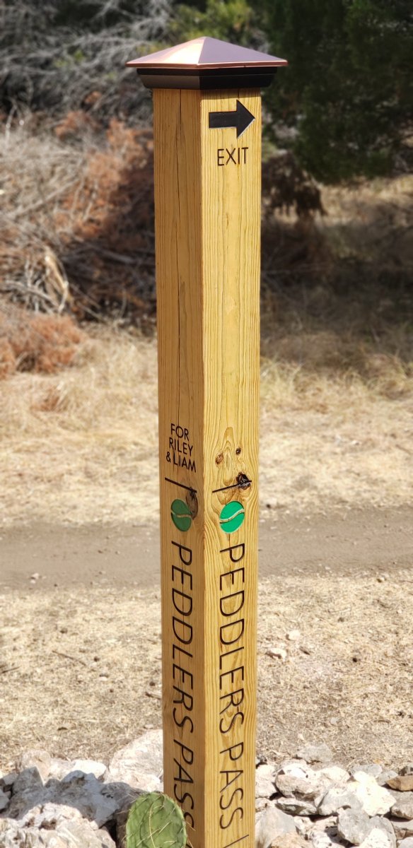
I like this idea. When doing the emergency location markers for signs we ran into this exact problem. People thought they could use the GPS locations (lat / long) to give an exact location. After all, they could read it off their phone and relay that to 911 or whoever. Yeah right. In a stressful situation you are going to read two 15 digit numbers off your phone to someone who is going to write those down perfectly so they can transfer those to the person who will actually go help the injured rider. Not going to happen. one lost digit or transposed digit and the location could be off by miles. And don't forget that many GPS "systems" use different methods of those locations. Some use negative numbers. Others use positive numbers ONLY. Some use degrees minutes seconds then start decimals. Some go straight to decimals. This quickly turned into a big a mess as saying 'I'm by the drop with the big tree and the rock...'. Mile markers were almost as bad. Ask a person "what mile marker are you closest to" and they will give you the reading on their GPS/Strava. Assuming you know where they started, know the exact path they took, and they never doubled back or sessioned anything, that might get the first responders close. Miss any one of those details and chances of finding them quickly are slim to none. ARR started using a 3 digit location identifier. The first digit tells the first responder which "entrance" to use (almost all trails have multiple entrances like BCGB) or zone (break the trails into different areas). The other two digits give an exact location. Most land owners / land manager liked this system. This is what is used on most trails with signage. Some land owners / land manager hated it. They thought it was too illogical. It could wind up with numbers physically close together on the trail but vastly different numbers. For those areas we use a grid system. (Like most maps with letters across the top and numbers down the sides.) That identifies to the first responders to a "square" but then it is up to them which part of the trail thru that square they need to find. Both methods have good points and bad points. The 3 words system helps some. If it catches on and most people (land managers and first responders) know what this is and how to use it - we will change to use it. That way there is no "special map" needed to decode the locations. For some reason, some land managers chose to keep that map to themselves.1 point
-
Yes, thank you mack_turtle for the tour! Saw lots of new trail I had never ridden before, and it's just incredible how much trail is down there and how interconnected everything is. There's no way I'd be able to follow that same route without making a ton of wrong turns and backtracking. I need to make an effort to get down there more often for group rides, as that's the only way I'm really going to learn the trails. ..Al1 point
-
I like my sugar with coffee and creme. 🤖1 point
-
Man, I wish I was going to be in town for this, as I'd love to partake and do all three routes.. Sounds like it'll be a ton of fun!1 point
-
One of the unfounded biases I had when I moved here a dozen years ago. Once I got over myself, I realized that riding here IS fun and can be challenging. That said, I ride with a 32 90% of the time.1 point
-
Everyone. Is. Different. The lack of context is stunning. But expected. This is like saying "there are lots of cars out there these days, what are the best ones, without narrowing the field to how you drive, how many people are in your family, what you are looking for in a car and what your budget is. A new Mercedes and a 2004 Hyundai are both viable answers. There you go.1 point
-
1 point
-
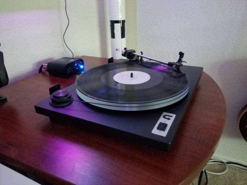
No buds for this one. Just loud, hard driven speakers.
 1 point
 -
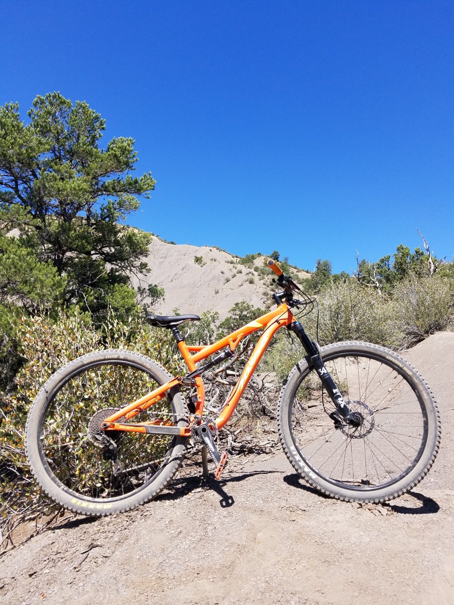
Finally done!
 1 point
 -
Or borrow Mittens for a bit and let him hang out there. I guarantee no one is going over that berm if he's curled up down there.1 point
-
I'm inspired and hate my SRAM Level T brakes. I'm going to pick up a pair of M7000's too. I'm going with this listing which includes rotors and pads for $183 eBay Link1 point


.thumb.jpg.07ee12b2da3df67be485333447c664f3.jpg)