Leaderboard


.thumb.jpg.07ee12b2da3df67be485333447c664f3.jpg)
Popular Content
Showing content with the highest reputation on 07/31/2019 in all areas
-
Good call. I always do that "...how would this play in my news feed?" test. It's kept me from going on vacation and leaving the kids at home on more than one occasion.3 points
-
Great job, except you forgot to tie a noose at the end for the A-hole to use 🙂 Thanks again for all your work with this!3 points
-
He put it down - he should get the glue back up. That might need to be explained to him by someone of proper authority. The sign and game camera bluff are good. I'm not so sure about the rope. In liability cases I understand (I'm not a lawyer) that if it is a "natural feature" then all liability is on the user. They can chose to crawl up/down that rock but they can't sue anyone over their decision. If there is a "man made feature" (e.g. ladder, rope, handholds etc) then there is someone to sue if something bad happened. The rope and attachment would have to be regularly inspected and documented to be "safe".3 points
-
Work thru the Trail Steward to get approval. If the land manager is OK with it - put a rope there. When talking to the land manager, don't bring up liability. Let them decide what issue are important to them.2 points
-
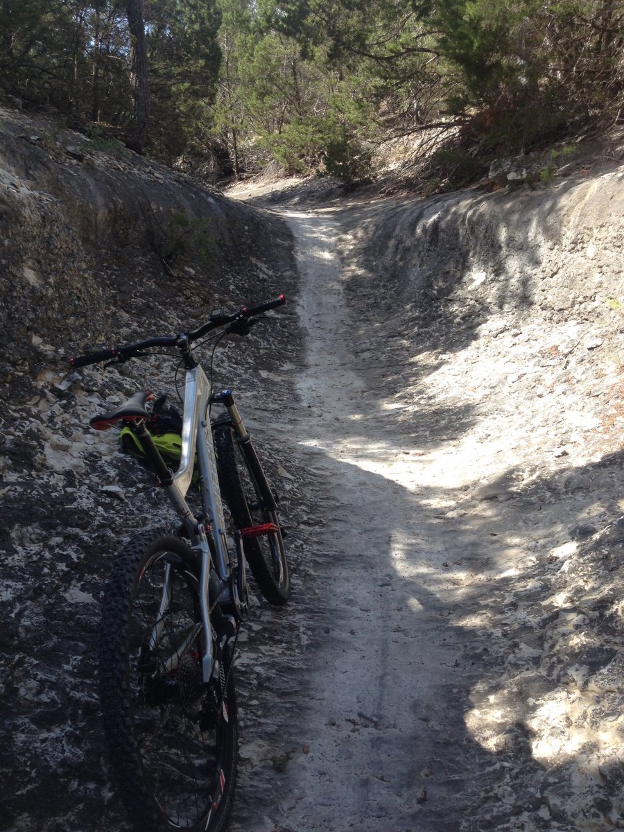
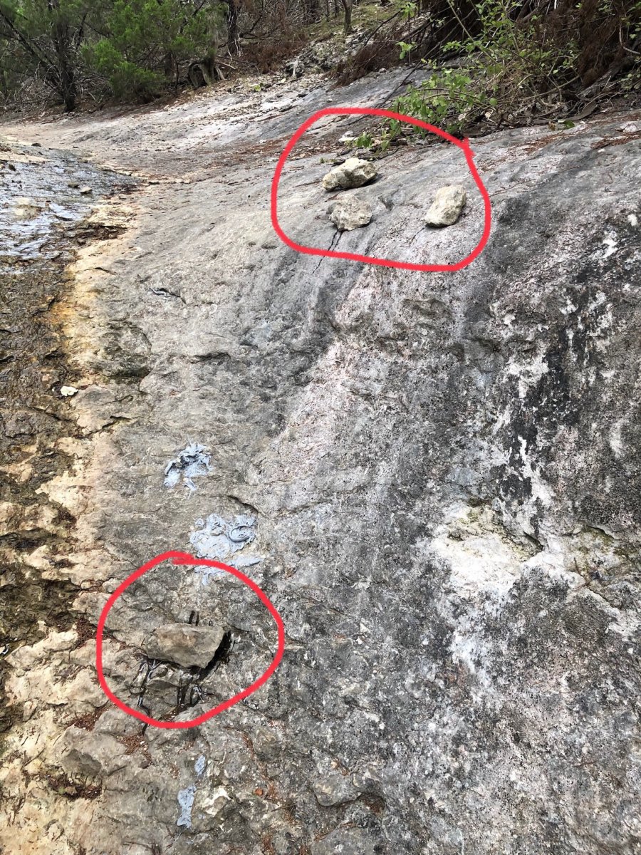
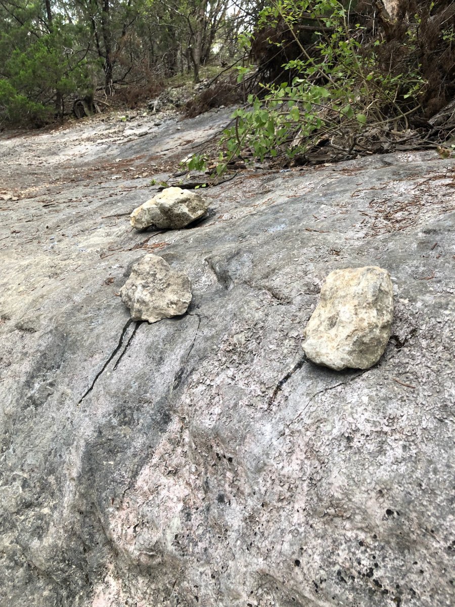
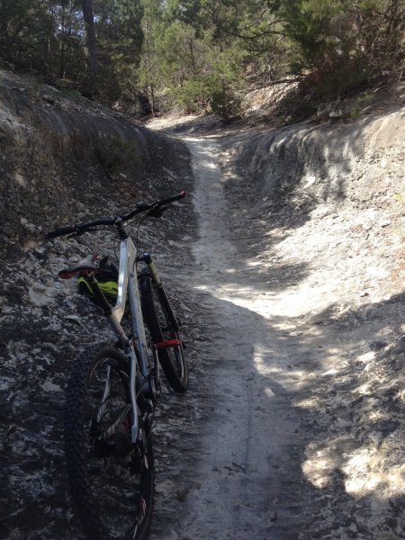
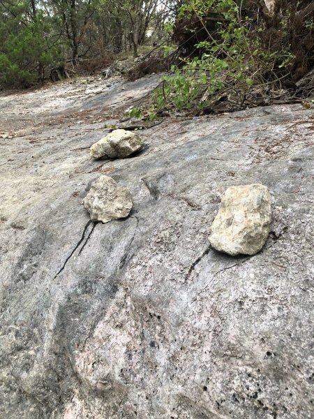
I haven't ridden that in a long time, probably since they built the subdivision up on top. When I first started riding there it was almost always dry. I used to climb up it on my bike and that was actually more fun than going down it. The wet started when they started building up top and it's been wet ever since. I think some of it may be runoff from people watering their yards. I have slid on my ass getting soaked a few times while walking the dogs out there. People are unbelievable "let me take this beautiful work of nature and fuck it all up with some stupid handholds so my entitled ass can get up it". Thousand of years for erosion to create that and some idiot fucks it up in a matter of minutes. Stupidity and entitlement make me want to get off this rock ASAP! I was totally blown away by how amazing it was the first time I was ever up there, to be able to stand in something like that really lets you know how insignificant we really are. Pics included.
 2 points
 -
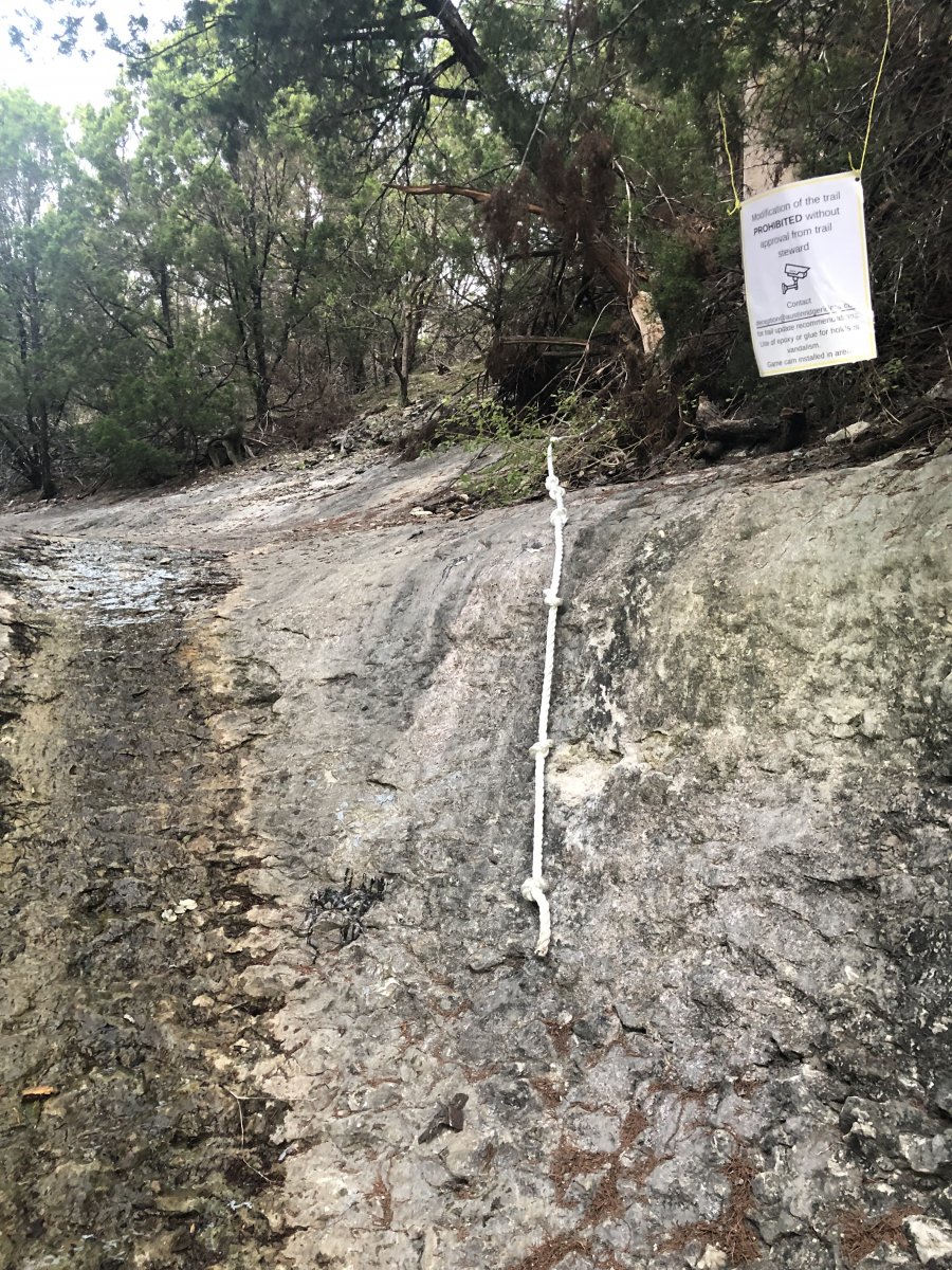
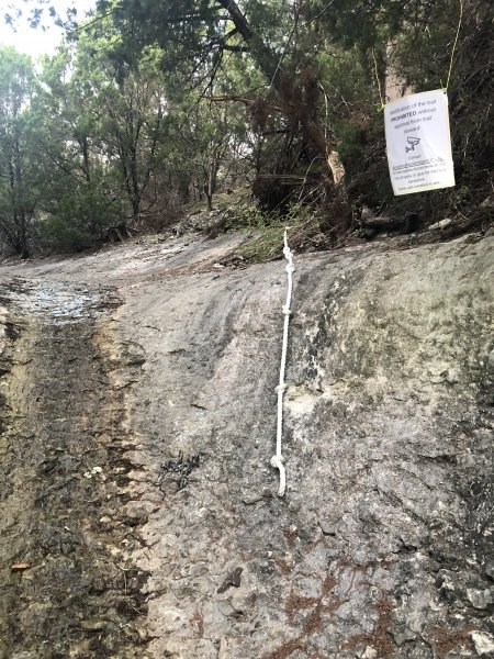
I went out this morning and added a sign plus a rope to provide assistance up. I’m hoping this mitigates any further damage to the area or placement of holds. If a trail steward feels this is a major hazard then feel free to remove or discuss with me and we can come up with an alternative. Also, if you read the sign, there really isn’t a game camera put up, but they don’t know that!
 2 points
 -
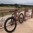
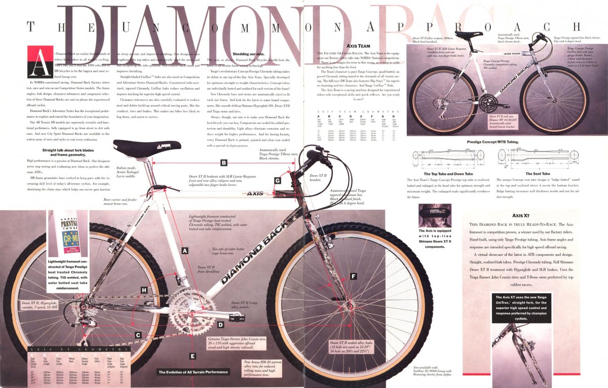
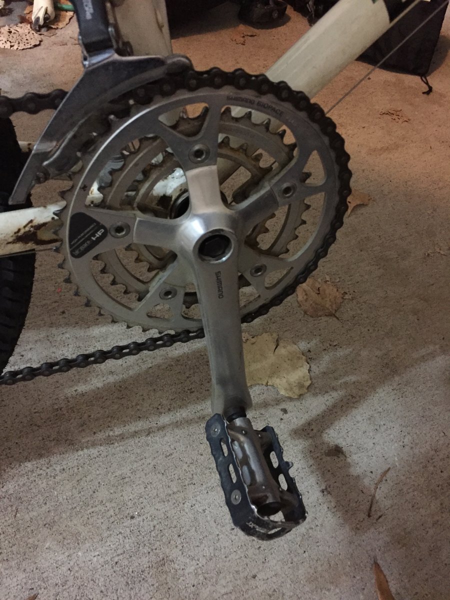
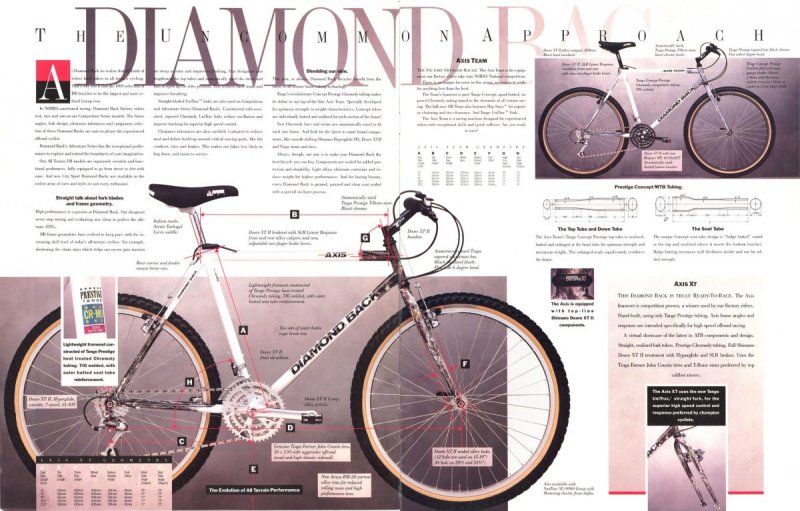
Big smile on my face when I came across this fella... And it's now sitting in my workshop. Rides like a dream. All original 1989 Diamond Back (that's how they spelt it back then) Axis XT...


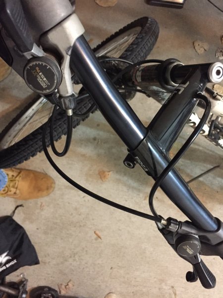
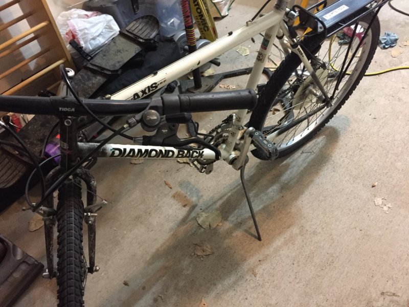
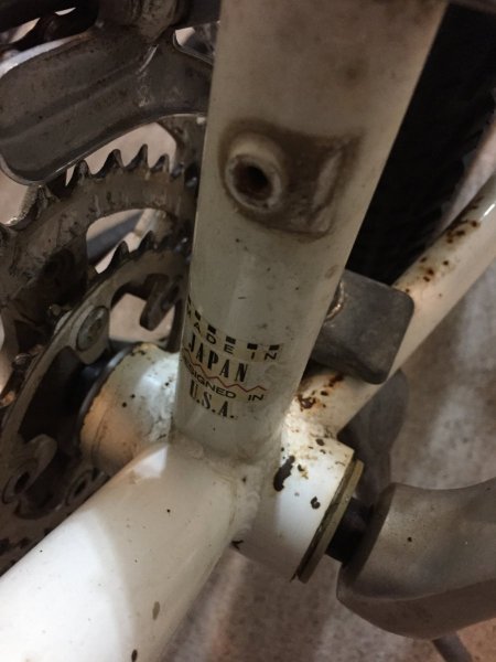
 2 points
 -
There's always fishing - oh wait is it still Shark Week!2 points
-
Ha! I removed it. We live in an incredibly sensitive world, so I'll hold off on the noose 😉 I can see the news headline now...1 point
-
The wood features are about the same. The difference is that a rope is expected to be a limited life item. Wood will rot but it takes a long time (years). I expect nylon or other 'plastic' rope would be brittle in about a year (ultraviolet damage). A natural fiber rope (hemp) is about the same but due to rot instead. The liability issue is why ARR insurance limits wood features to 24" above the ground. But we can pile dirt higher than 24". On FB I suggested using the rope to have a hangman's noose next to the sign.1 point
-
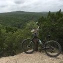
Back 40. Sidewall cut off Ledges. Amazing temps up there last week
 1 point
 -
I'd at least be interested in following the water up stream to get an idea of water source. It is possible that there is a pipe leak somewhere that isn't being detected. There should NOT be any water flowing through there right now, yet it's still a pretty good flow.1 point
-
Good one.1 point
-
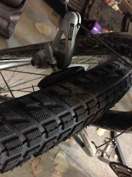
I had a Pitbull rear brake too. Cool looking but horrible in every way!1 point
-
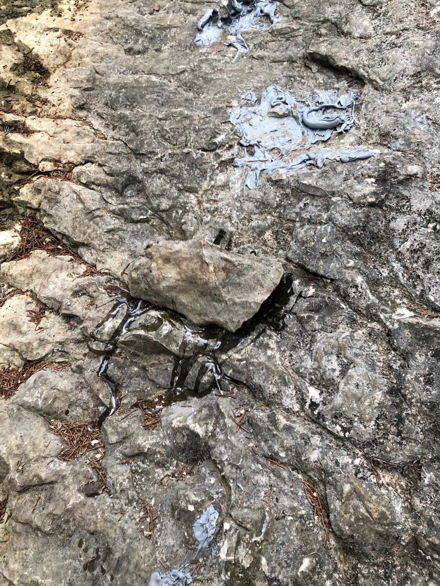
I have a cordless drill that I can use a brush wheel attachment on to clean up the area. May try that tomorrow night. The silicone stuff he used comes up easily but that epoxy is going to be a pain.1 point
-
@Greenmtbrider Thanks. Seems like his prime time is later in the evening perhaps. I wish i could go out tomorrow and sit there. Guaranteed he will show up to check on his fine work. Let me know how your plan goes ill be at work all day and check back on thurs. He really is making a mess of the beauty of that spot. Not to sure how to get that crap up. Sent from my SM-G950U using Tapatalk1 point
-
Just got back from checking out Dave’s Ditch. The guy came back and used epoxy this time to affix the holds. I took them off but the epoxy will be very difficult to remove. Kat and I are headed to Home Depot now to get a rope to sling on the side for this jackass to use and I’ll be out there tomorrow morning putting up signs.


 1 point
 -
What would Bart do? Sent from my SM-N960U using Tapatalk1 point
-
In 2.5 years of riding on my primary bike 8 to 15 hours per week, I've had the Fox Factory fork and shock serviced once at the shop. Just recently I took it back in due to a little play between one of the stanchions and the lower on the fork, and they sent off to Fox for a complete servicing. It came back like new, and there has been no indication that I've been damaging the fork beyond repair by not having it regularly serviced. So for me it's once every 18 months for shop service unless something doesn't feel right, in which case I'll have it checked out. I simply don't have the time or patience to be doing it myself and don't believe in paying for more than I really need.1 point
-
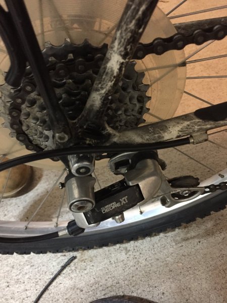
Mack_turtle is right. Not that you're considering this, but there have been cases where floating rotors such as Hope's wouldn't play nice with other calipers due to the rivets on the carrier catching the caliper. Also, some discs have a different thickness, but that usually doesn't cause an issue that can't be fixed by a little pad spacing adjustment. About truing rotors...yes it can be done. But at $35 for an ice tech rotor, just get some new fresh ones and be done with those SRAM rotors.1 point
-
We're clearly doing something wrong, then.1 point
-
Up until now, I used to ride down that when it was wet. Now you guys have me a freaked out and skert to leave the house. Thanks1 point
-
I only ride down when it's wet in the event that some asshat is perched in the ditch gluing down rocks, in which case I fishtail into said offender to help maintain my own stability while also disrupting their dirty deed. There, now its related to the event. In all seriousness though, I rarely ride that section unless we're in an extreme drought because it seems to always be wet and slippery as hell. Somebody posted a few months ago about a rider being seriously injured after slipping on the way down. The alternate route, Dave's Glitch, is equally fun and more challenging anyway. Just go to your right instead of your left when approaching that climb up to the top.1 point
-
Nope, if that first drop is wet, I turn my ass right back around. I tried scrambling down it once when it was wet, and that resulted in an uncontrolled slide on my ass, after which my ass was soaked in the muck accumulating on that drop.1 point
-
I love this forum because everyone is so nice and helpful. I should probably google half of the shit that I ask on here, but I love the wisdom and experience you all have. Hopefully you like answering the questions too!1 point
-
Neighbors bought a bike for their kid online and I offered to set it up. Took me less than 30 minutes including unboxing and getting rid of the box. They came over to pick it up and brought 2 really nice bottles of cabernet. At that rate I was probably paid ~$150/hour or so for my work. And the kid's bike was set up right.1 point
-
There were moments a couple days ago I might have seen fit to use an e-bike ... 😅 and still, I persevered and rode (hike-a-biked) on. In the greater scheme of things I feel more disdain toward an inconsiderate Stravasshole giving all riders a bad name by their treating a shared-use trail as their personal race track than I do toward someone riding pedal-assist in a responsible and considerate manner.1 point
-
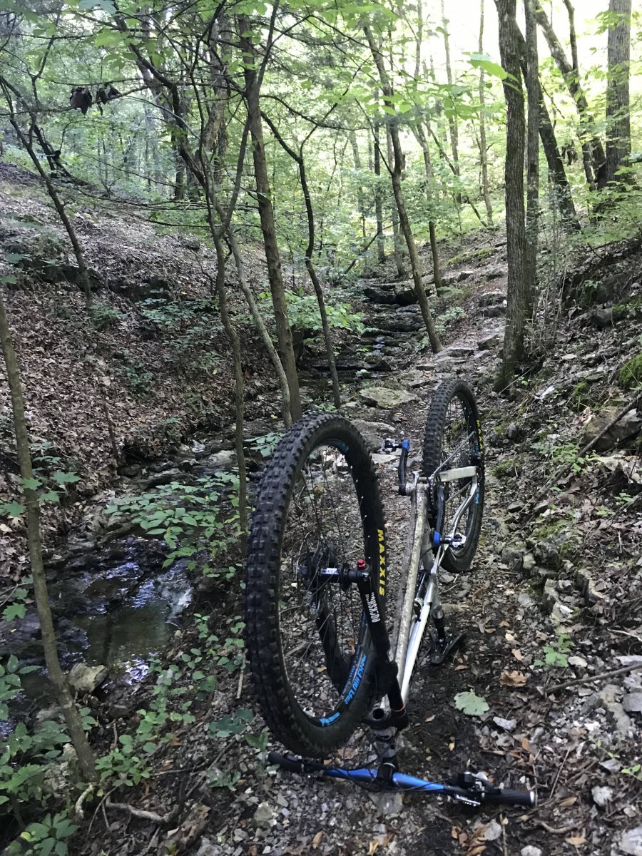
Today on the GB.
 1 point
 -
THE SHORT BUS - or - Winsor down connecting to Dale Ball trails After boarding the short bus in Santa Fe at the South Capital Station stop and putting a sawbuck in the slot we were off to the Ski Area where the Winsor trail head is found. I was the only rider at the first stop, and we picked up four more before departing Santa Fe for the summit. There were two local youngsters dressed in full downhill regalia, full-face helmets, padded shirts, knee, and elbow protection. The others were a couple from Reno/Tahoe area who had flown in and rented a pair of Santa Cruz bikes (similar to what they rode at home). Once at the Summit the couple (Charles and Barbara, IIRC) were the first ones on the trail as the two guys fiddled with air pressures and I added some to the rear tire too, as well as taking advantage of the last restroom I would see for many hours. The guys headed out away from the trail entrance and I figured they might be going on up to the higher section of the Winsor to begin their day. The TH is at about 10K feet and the air is very, very thin up there. I had read that the first section of trail was kinda rough, but hadn't figured in the near absence of oxygen. Rocks, roots, and OMG ... uphill sections, one after another. I was breathing very fast and still felt like I was on the verge of swooning. Several times I had to stop and wait for several minutes to accumulate an adequate amount of O2 to manage a few more steps as there was no way I would try to ride with my head spinning like that ... After some amount of time and distance I crawled out onto an area where the trail came close to the road and there was parking and signage. This was near the top, probably less than a half mile in. I found where the Winsor continued down and the trail was a lot better. After a while I came upon the two locals who I had thought had gone higher to start their ride. This was confusing for a moment. They were stopped in the trail fiddling with more settings, air pressure, and I was scratching my head about how they got in front of me. We talked and they revealed that nobody who knows better ever rides that section I had just done, and they had coasted down the road to the next trail head to avoid all that crap. Very Important Note (VIN) 1 - Do NOT start this ride at the top. Skip the rocky, chunky, rooty bits and give your body a break from trying to wrestle with attempting full functionality without O2 in adequate quantities to sustain the efforts required to get through this section. Unless you just want to experience that rush of asphyxiation. (ala David Carradine) I got around the locals and headed on down. The trail smoothed out and was a joy to ride in comparison to that upper bit. Next was a split in the trail, to the right was labeled "Technical Trail" and to the left was plain-ole Winsor. While I was pondering my choices the guys rolled up said hi again (they were very polite and good natured fellows) and took the right. I took the left. This was the last I saw of those guys, and I'm pretty sure they remained behind me as I heard them whooping and hollering when I passed the point that technical trail rejoined the Winsor. The Winsor is an absolute blast. The section I rode was nine miles of mostly gravity induced grins. Eventually I caught up to Barbara and she heard me and made room, then a few minutes later I rolled up on Charles waiting for her. We compared trail plans and it seemed that they were essentially doing what I had mapped out and we rode together for the balance of the Winsor section. They were my age (well past a half century), and Charles was a very good rider. I stayed close, but wasn't wiling to push it like he was, mostly because I was being cautious and slowing for the potential of hikers or an uphill rider (actually encountered one rider going up) being around the next bend where I couldn't see. We slinkied on down pausing for Barbara a few times, and started looking for where we needed to bail in order to head toward Santa Fe, rather than toward Tesuque where the Winsor finally ends. It got tricky, and Charles had been warned by the folks at Mellow Velo, where they rented, that the trail we wanted was Carol, and not to get on Burn or take Carol to Burn, and that finding Carol could be confusing. Well, it was. Even TrailForks with GPS didn't seem to show me being at a point where there was trail to the right when we came to a Y with no signage. The GPS showed we had completely missed seeing Burn, flying past it on the downhill, but also weren't to Carol yet. Charles scouted the trail to the left while Barb and I took a moment to have a bite and sip some water. He rolled back to a spot nearby and reported it seemed most likely the trail we wanted. "Wanted" being a bit of a euphemism, as sweet little Carol led us on a climb of 466 ft over the next mile. I did meet a hiker wearing a Specialized cap walking down and commented how it may have been a mistake for me to bring a bicycle along on such a nice hiking trail ... the first of several such climbs in my future. After my hike-a-bike on Carol the descent began. Though it seemed like a mirage or, perhaps a lucid dream after that climb. I've always wanted to experience lucid dreaming and just rolled with it, enjoying the front wheel being on the low end of the trail for a change and some wind to make the magic in the Omni-Zero fabric perform magnificently. I never saw Charles and Barbara again. She had been leaning toward convincing Charles to head out to Hyde Park Road by taking the left on Little Tesuque Creek trail at the end of Carol. She wanted to take pavement back to Santa Fe after I had described the elevation for both Carol and the next trail and I'm suspecting that is what they did. Smart folks they are. A quick glance at the computer and I realize how the halfway point for the expected mileage today has now been attained. It is at this time I will take a moment and make note of one aspect of the ride that proved to be a disappointment. The outdoor air conditioning had apparently been turned off, and where I had been expecting highs in the low 80s, I was seeing the temp on the bike computer now ranging up into the 90s and as high as 109 in places as I crawled up Carol, pushing the bike along my hike on many sections. I got to the T and briefly pondered taking the left to easy salvation, then, chose to take the right. Stick with the plan I said, as it included riding some of the Dale Ball trails. I've brought 4.5 liters of water with me I said. Columbia's shirt had magical properties that were doing a great job of heat management I reasoned. (if reason is what that can be called, still, it added to the justification to press on, regardless) Besides, I've never been keen about riding a bicycle on busy, narrow mountain roads. To the right it was, onto Little Tesuque that takes the rider foolish enough to go this way directly to the La Piedra Connector. More about that in a moment. Little Tesuque trail follows the creek into an environment that was full of lush water-fed grasses. A microcosm in the otherwise high desert surroundings. It was quite lovely, lulling me into a false sense of serenity and calm as I found a nice spot to stop and have a bite, down a fizzy tablet of electrolyte goodness, letting it disincorporate into mouth fulls of water while I bided my time enjoying this cool, breezy, shady respite. Little did I know the onerous task, ney, torture, waiting for me unseen a mere 50 feet away. In Spanish the translation for La Piedra is "the rock" or "the stone" and that is sweet and all, but in the local Santa Fean dialect the translation is more like. "The god-awful chunk of rock that some sadistic bastard of a trail builder carved upon to test the will and very soul of anyone attempting to use La Piedra to connect a pleasant Winsor downhill ride with the Dale Ball trails. This jewel in the cap of Marquis de Sade's crown gains 674 feet over 1 mile of trail that includes a series of ~30 switchbacks with rarely more than 50 feet of very steep trail between turns. There is no riding up unless you have the skills of Hans 'NoWay' Rey or Danny Macskill. Walking up with a bike takes time. On the way I see temps steadily over 100, and was thankful that there were plenty of trees offering shady spots every twenty feet or so to stop, sip water, and trudge onward. VIN2 - DO NOT UNDER ANY CIRCUMSTANCES TRY TO CONNECT A WINSOR DOWNHILL RIDE WITH DALE BALL TRAILS just go on down to Tesuque and catch the bus back to Sante Fe. Really... I mean it... especially in July. I never actually thought I was going to die, but in retrospect I may have just been telling myself that as a way to ease my passing from this mortal coil should it come to that. As near as I can tell by signage and a remarkably stout cedar pole fence toward the top, this connector trail had to be built in a very narrow section between private property lines on either side. There is no other reason for it to have been built this way. Ah, here's a blog post on the construction of the trail. As I'm ascending this marvel of modern trail building I'm hearing the thunder of afternoon storms brewing over the mountain I came down. Big rolling, crackling noises, lightning zip-zapping between clouds, it becomes obvious to me how I'm now headed to the peak in order to offer optimal exposure for a rider seeking to become a high point should electricity be coursing through the nearby air seeking a convenient path to connect to the electrons anxiously awaiting the trip skyward from terra firma. Rolling spritely over the peak I gratefully descend on steep, yet rideable trail leading me to another Y. After study upon the choices on TrailForks elevation profile, I take the lesser climb on the right spur to begin another set of switchbacks that eventually get me the hell off of La Piedra trail. I have attained the goal. I am on the famous Dale Ball trails! Yay. VIN3 - Dale Ball trails aren't named, instead, the intersections and waypoints are numbered. This was quite confusing as the trails are described as "Dale Ball #2-#3" and such. Fortunately, they are well signed and once I became used to looking for the direction to the next marker, rather than thinking of them as trail numbers it became a breeze to navigate. The Dall Ball trails I rode were flowy fun, with an occasional climb. As an added bonus the winds being sucked into the base of the CumuloNimbus making noises nearby brought the temps down to the 80s and made the Dale Ball riding that much better. Here is the order of precedence for the Dale Ball trail markers as ridden post-La Piedra: 2, 3, 4, 5, 10, 11 ... At which point I'd like to mention how the trail crosses Hyde Park Road (NM475) between 10 and 11. When I got there I checked my watch. 1500 hours. I knew the last shuttle bus was just leaving the summit and I could wait here for 30 minutes and flag it down for a ride back to within a half mile of the house. I deliberated, I hemmed, I hawed, I applied all I know about survival in the wild ... In the spirit of all my previous decisions along this ride, I took into serious consideration factors such as fatigue, the heat, the dwindling water supply and, as you have come to expect by now, I crossed the road and entered the singletrack, away from the safety and convenience of the returning Short Bus, taking the trail that led, unremarkably, to yet another set of upwardly immobile switchbacks. Bus, schmuss. I don't need no stinkin' bus. I'm quite literally cranking it up, ... to 11, as it were. From there it was on to markers 12, 18, 20 and 24 which is an OMG FUN downhill to Cerro Gordo road. A guy at Bike N Sport had told me the locals will take a left on the pavement and ride uphill a little ways to Upper Canyon Road, then take it back into town because it is mostly downhill and has less traffic. Which is what I did. VIN4 - Do what the locals do and take Upper Canyon. Coasting, I was very nearly exceeding the posted speed limit of 20mph for much of the way. Final tally, Roughly 6 hours 23.11 miles from the peak to the VRBO 6317 ft descending (TrailForks) 3097 ft ascending (TrailForks) If an ol' fart like me can do this solo, you might be able to as well ... ... just don't cuss me, cuz I done told you it wasn't a very good idea.1 point
-
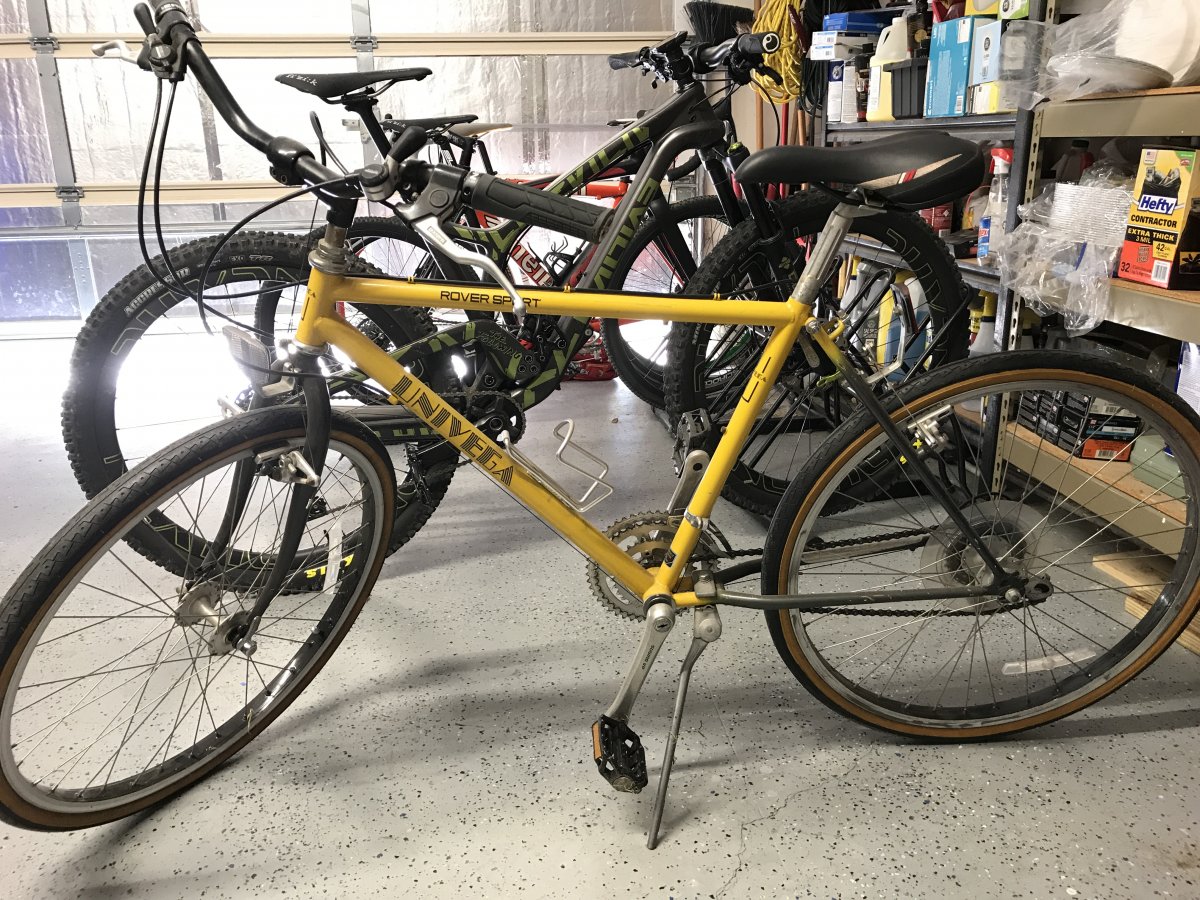
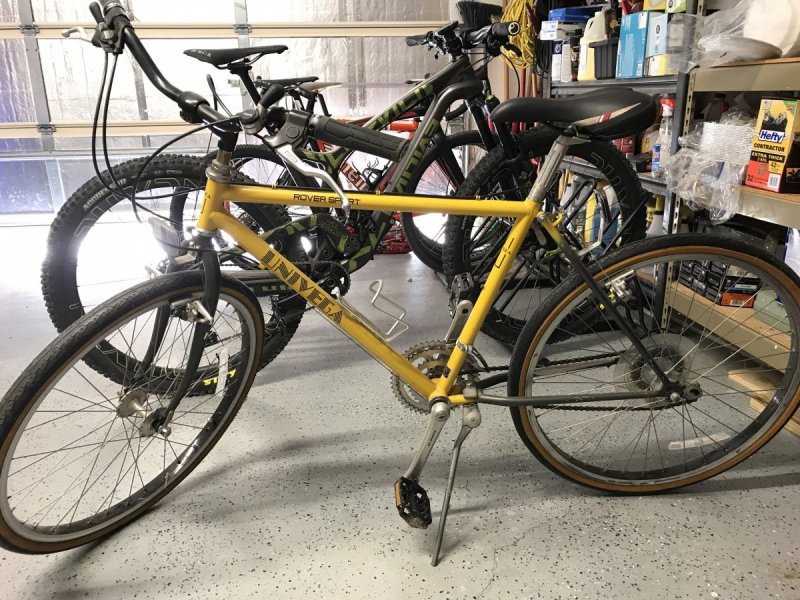
My wife's 1983 Univega Rover Sport all original except tires and saddle. My daughter has it now.
 1 point
 -
My first real MTB was a 1991 (could have been a 90) Univega Alpina low end model. (this one is not mine, go visit this cool blogspot: http://bicyclephotodiary.blogspot.com/2012/02/) I rode that bike on the BCGB, Emma Long, and some unmentionables for years while I finished school, then gave it to my brother when I upgraded to Kestrel CS-X with Mag21. That bike was tough and fun to ride. I loved the Deore indexed shifters. So simple and light! I bought it from a bike shop on 24th. I did more stuff on that bike than I do on my current FS. I lost a lot of skills and nerve during my years in the Dallas area. @June Bugnot long ago I picked up a 1994 Green Rockhopper (for $125) from someone that had bought it new, he'd rode it maybe a handful of times, and hung it in the garage. The bike was 100% stock including original clean chain grease and the cracked dry tires. I sold it to a co-worker for him to ride around the neighborhood.1 point
-
Those look like pit bull brakes! I felt like a boss when I got my pit bulls on my Bmx bike as a kid. Mine were white.1 point
-
bump1 point