Leaderboard


Popular Content
Showing content with the highest reputation on 10/17/2019 in all areas
-
Why not toss in Lake Georgetown and make it the Complete Chimichanga?3 points
-
That's the truth! Just ride Thumper for confirmation.2 points
-
Rob gives such a negative connotation. I'd like to think of it more like redistributing😉2 points
-
RR has a good 5,000 ft view of the site. Curious to see how plans come together when the RR staff has gotten a more in depth look at and boots on the property. We've had our initial round of input. Now go log some laps. Or if you're felling freaking, link Behrens to Wilco to Brushy.2 points
-
We should talk. I've been mapping out basically the same thing. Not sure when I'll get to do it, but there's potential for a pretty epic ride.1 point
-
Not on your list of options but I use this when I don't have a 1 Up on the truck. https://www.saris.com/product/traps-triple A while back I installed a tonneau cover which comes in handy when I want to park up in a public place and conceal the bike.1 point
-
Ha. Nope. I reported it to Ronan when i daw it being dumped. There was a white truck with 2 guys looking at the beginning of the new sidewalk at the intersection of Parmer and Brushy Creek rd. So its for something way less cool. Just wish they weren't assholes about where they dumped it. Ronan suggested we rob as much dirt as possible since its on the trail. Sent from my SM-G950U using Tapatalk1 point
-
I don’t think anyone involved in the EB prepares new trail, or B lines either. You are preaching to the choir.1 point
-
Don't care. Getting the word out. Pass it along. Sent from my iPhone using Tapatalk1 point
-
It appears to have just been done, possibly in preparation for the Enchilada Buffet this weekend. DO NOT CUT NEW TRAIL AT EMMA LONG (aka City Park)!!! The City (PARD) and BCP watch Emma Long like a hawk. There are currently plans in the making by the City to GPS the trail at Emma specifically to track (unauthorized) changes. DO NOT CUT NEW TRAIL AT CITY PARK. Sent from my iPhone using Tapatalk1 point
-
I responded on FaceSpace as well. I plan to be there, and I saw some smoke signals which indicate that perhaps @knifezilla will be there as well.1 point
-
Turkeys still pass through there. Have seen a few Doe's, couple Hogs and a Coyote (today). Good MTB'er turn out at the meeting tonight.1 point
-
Seriously, they're the kitties titties right now1 point
-
Boys, if you didn’t ride today I feel sorry for you. Best the trails have been all year.1 point
-
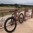
i just put my bike in the truck bed.1 point
-
Not much help for your application, though I had the same preference toward not removing the wheel. I sold my pickup and bought a van. Problem solved. .... the fact that it is rated for over 2 tons carrying capacity, has lockable enclosed storage, and gets about the same mpg as the pickup I sold helped make it an easy Tundra to Transit transition for the Transition (Covert 29).1 point
-
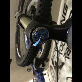
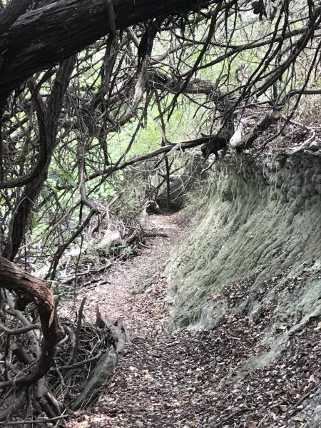
THUMPER CHEAT SHEET These 2 photos are to explain the different signage you will incur on the Thumper trail. In very simple terms, ignore the color signs/arrows. There are 2 main types of markings: 1) Black/white arrow signs. The signs are the designated "bike arrows" that are left up year-round and should generally follow the trail along its route. 2) Yellow tape across the trail. The yellow tape pretty much marks off traill sections that should not be used. Do not ride over the yellow tape. The B/W arrows and yellow tape should not contradict each other. *NOTE* there are a few leftover EB 2017 signs out on the trail and they should be accurate. In this photo below you can also see the small EB2017 marker above the B/W arrow sign. This is an example of a left turn marked by just a B/W arrow. The trail only goes left around the tree, but to the casual rider it may seem like they could go straight or even gently right if they are not paying attention to the B/W arrows. This is one of the more historically confusing spots. This photo is showing a portion of the 2-way section of Thumper trail. The perspective is as if you where "coming back" towards the end of the 2-way. You will drop down the ravine and take a firm left around the small tree. The illustrative direction arrows show the 2-direction and how its traveled. Additionally I've circled the B/W arrows and the smaller EB2017 arrow. But please be alert for these kinds of markings while out on the trail. The photo below is the same section as above. However, its further back and without the illustrative arrows1 point
-
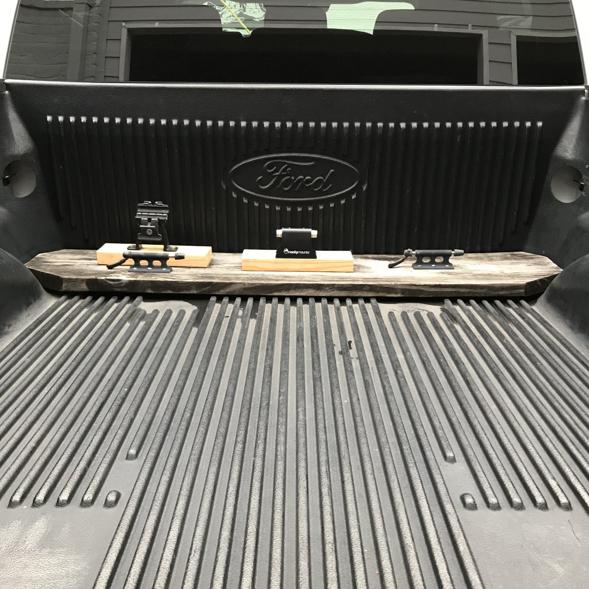
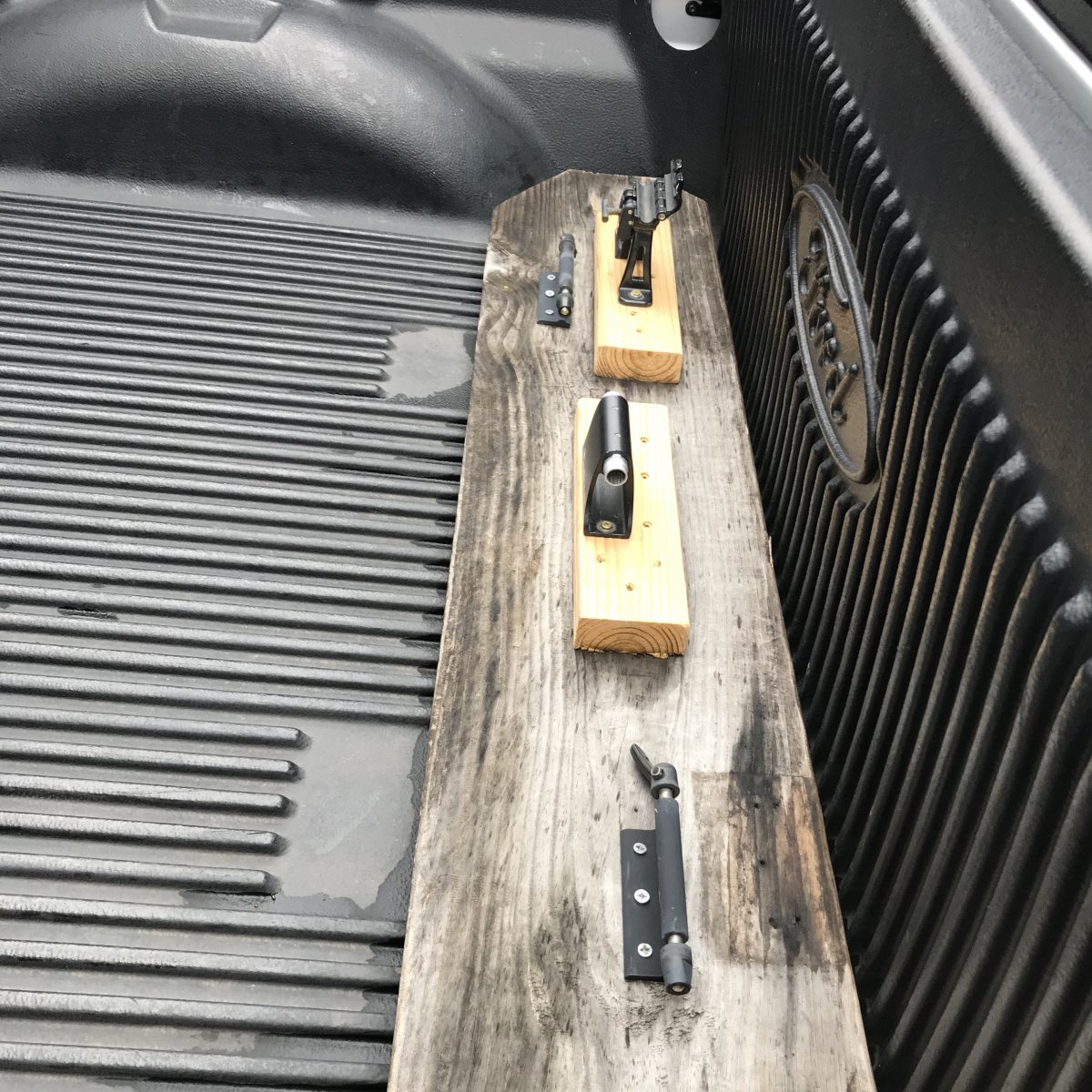
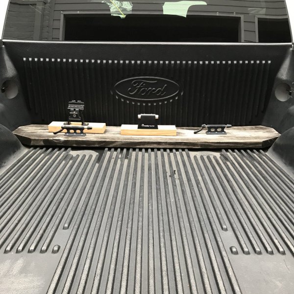
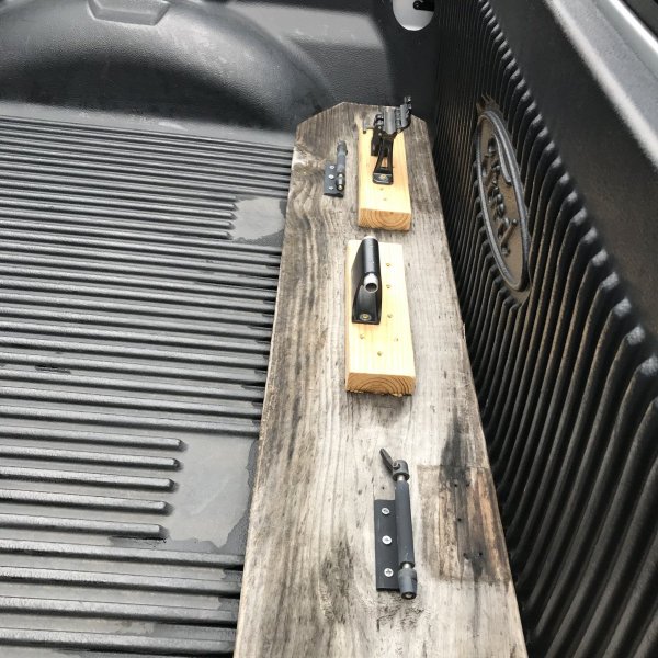
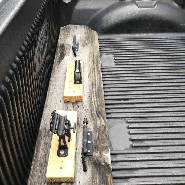
I vowed to never run a hitch rack again after I was rear ended and had to fight Allstate to replace my $500 kuat rack as well as my $3,000 Trek Cronus Pro. Been running this since I bought the truck May 2017. Recently replaced the 2x4 sections, but that was after 2+ years of weather abuse. Pull the front wheel and toss it in the back seat. The Rocky Mount on the driver side locks the axel, but I also attach frames to corner hooks in the bed via cables when I think security is an issue. I plan to revisit this soon to add another mount.
 1 point
 -
This is how I feel about Gnargasm or whatever that one is with the boulder to ladder. At some point a rear wheel skid does nothing and you still accelerate. I eyed it up then said I'm cool to walk this one. Some people say f it and just huck off rental trucks tho.1 point
-
Oh yea, I've ridden there before. There were a few trails at the time. Unfortunately can't make the meeting tonight. 😞1 point
-
Myself and Rugger are popping in Sent from my SM-G950U using Tapatalk1 point
-
So my trail report is as follows: if Gumdrop East is dry (including rock face at entry) then it’s probably all boobs except maybe peddlers’ dirty butt. but it’s a perfect day for riding whatever is rideable. Encouraged thus far. Update to update - rode all from Gumdrop to YMCA. Imagine the overall weather + hero status of the dirt being a 10. Now translate that in your own head to breasts...whatever that means to you, and that’s how things are out here. Unngh.
 1 point
 -
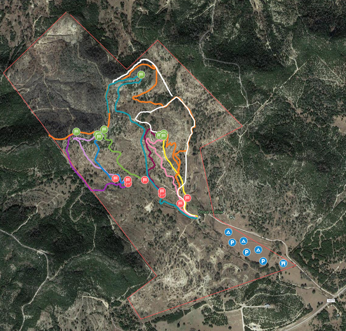
BANDURO EVENT/STAGE MAP IS NOW AVAILABLE! this is a live GPS map that will show your exact location in realtime from your mobile device! stages, parking/camping, registration, and staging areas are marked! tap on the link to have access to the map - https://drive.google.com/open?id=1zRMuDDDng8pcIcL1OvtJrIkIkmBTrZGl&usp=sharing Stages are as follows - Stage #1 - Widow maker - (All Classes) Stage #2 - Sidewinder - (All Classes) Stage #3 - Younger Gang - (Amateur/ Expert/ Pro) Stage #4 - James Gang - (Amateur/ Expert/ Pro) Stage #5 - Seth's Revenge - (Amateur/ Expert/ Pro) Stage #6 - 8 Seconds - (All Classes) Stage #7 - Reckoning - (All Classes) Stage #8 - Aces & 8s - (All Classes) get registered and get ready for this awesome event! Bikereg.com/Banduro
 1 point
.thumb.jpg.ffa2b46842a35c8cc883d0b9db87178c.jpg)